Equestrian Land & Building Surveys
Precision Equestrian Surveying Services: Elevate Your Equine Spaces
Measured Surveys tailored for the Equine community
Welcome to a world of precise and insightful surveying tailored for the equestrian sector. Whether you are an equestrian club owner, manage a competition venue, or are building elegant stables on expansive land, our services guarantee you clarity, accuracy, and a solid foundation for all your development needs. Gain the upper hand with meticulous and comprehensive data, ensuring your spaces are optimised for ultimate equestrian use. Meet us at HOYS next week, and let’s explore how we can elevate your equestrian spaces together.
Tailored surveying services to meet your requirements

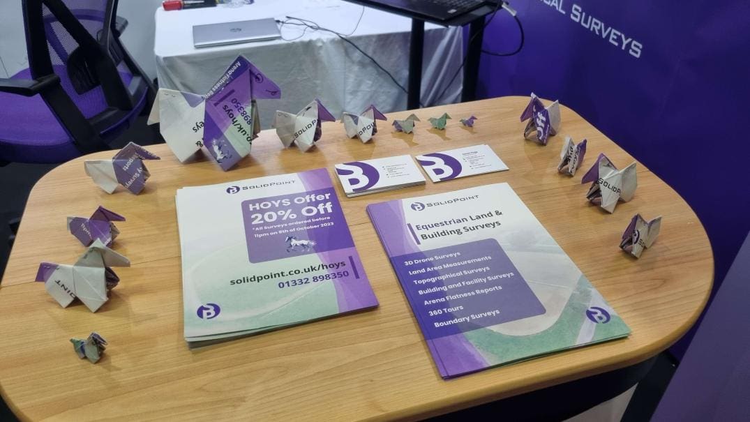
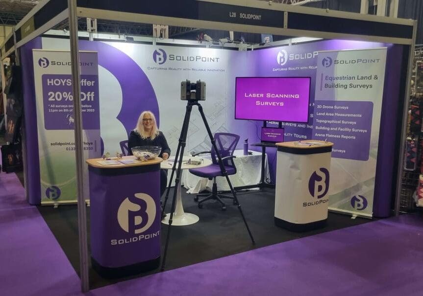
If you visited HOYS (Horse Of the Year Show) at the NEC over the last week, you’ll have hopefully stopped by our stand, taken a mint or two and maybe even acquired one of our origami horses.
Our team were there to help explain how our surveys and services are used within the equine industry. In case you didn’t get chance to stop and talk, we’ve listed the services below, some examples of how they can be applied to your projects and the benefits they will bring.
We hope you get in touch so we can provide you with a no obligation free quotation and advice on the best way to ensure that we provide you with the information you need to take your land or building development project to the next level.
3D Drone Surveys:
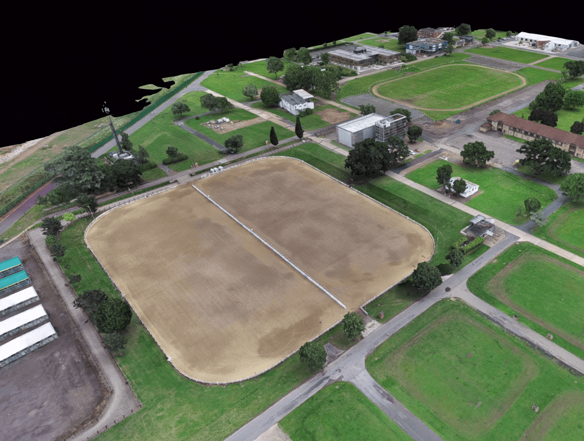
Purpose: Deliver an unmatched aerial view along with detailed 3D models of equestrian properties, offering a comprehensive visual and data-rich insight into the land and facilities. Applications:- Aerial assessment and 3D mapping of land and facilities.
- High-resolution imagery and 3D models for marketing, planning, or documentation.
- Identifying potential issues or areas for improvement with a multifaceted aerial and 3D perspective.
- Offers an extensive and clear aerial and 3D view of equestrian properties, providing clear understanding remotely.
- Augments the planning and assessment process with detailed visual data.
- Provides high-quality imagery and 3D models for various impactful uses, enhancing the value and appeal of the property.
Land Area Measurement:
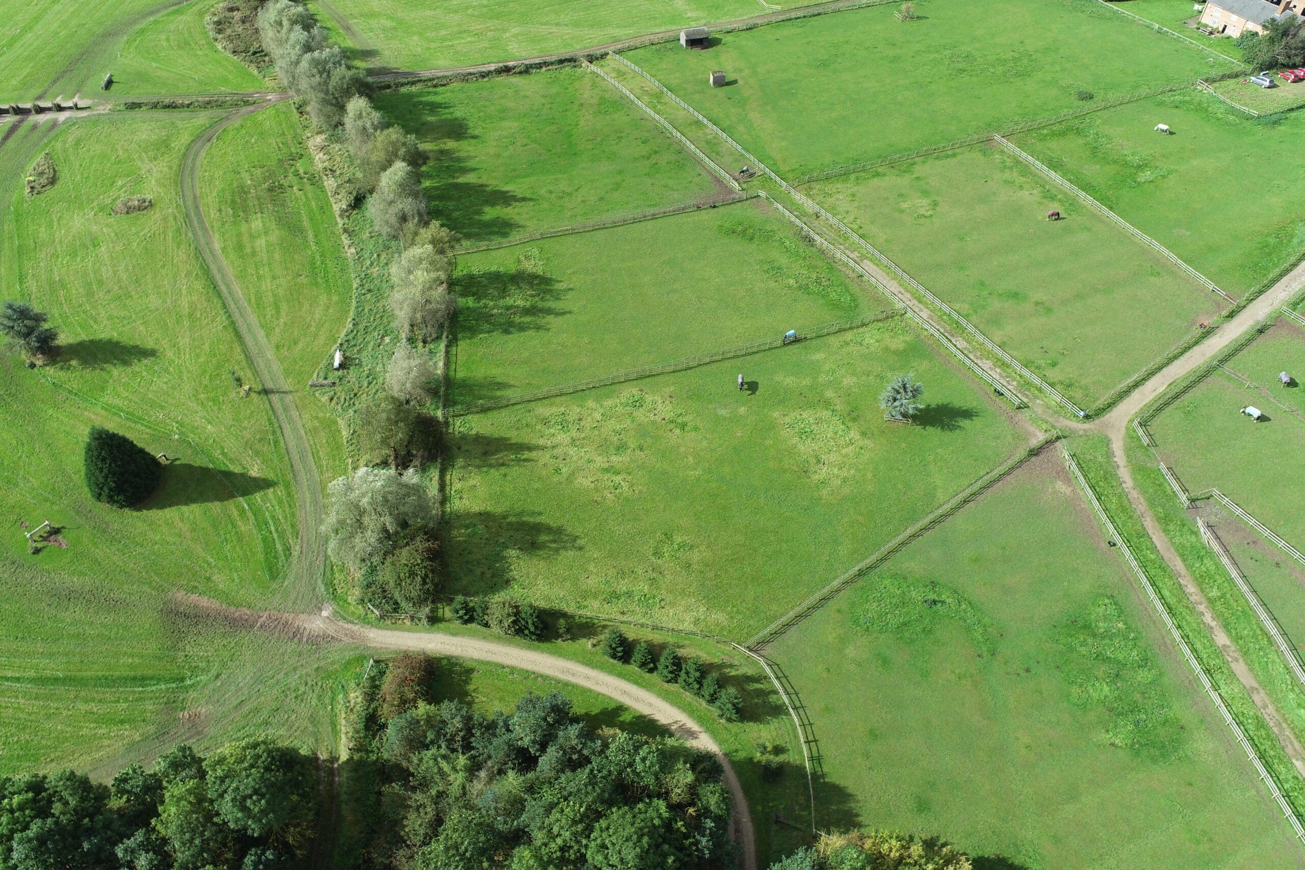
Purpose: Offer precise land area measurements, guaranteeing the effective allocation of space for diverse equestrian activities. Applications:- Accurate division and allocation of pastures.
- Space planning for stables, arenas, and other equestrian facilities.
- Ensuring sufficient space for riding trails and training areas.
- Provides exact measurements for streamlined land division and use.
- Enhances equestrian facility and land management.
- Guarantees dedicated space for all equestrian needs.
Topographical Surveys:
Purpose: Supply detailed topographical data for equestrian lands, aiding in effective evaluation and comprehensive planning of equestrian facilities and spaces. Applications:- Layout design of riding trails.
- Planning of training and competition areas.
- Elevation analysis for construction and landscaping.
- Identifying optimum sites for new facilities.
- Offers invaluable data for land utilisation.
- Aids in creating horse-friendly and efficient environments.
- Supports informed and cost-effective planning and development.
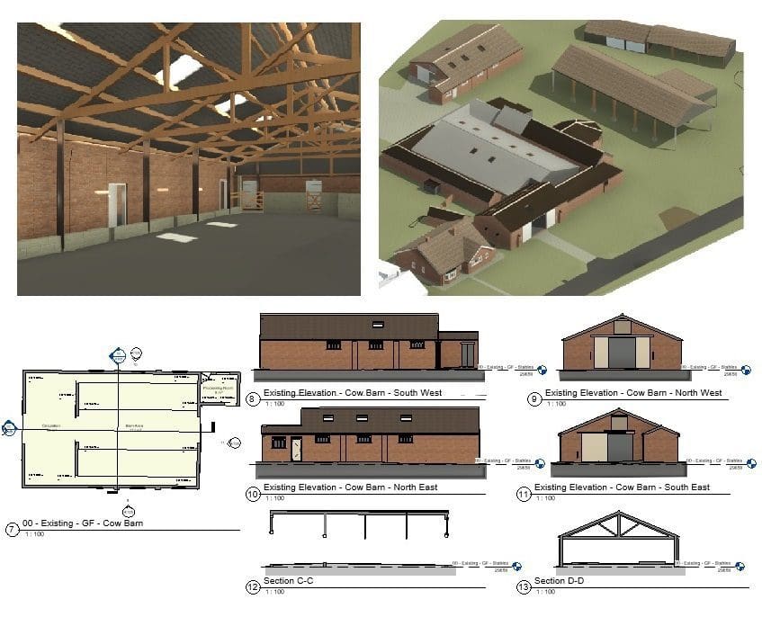
Building and Facility Surveys:
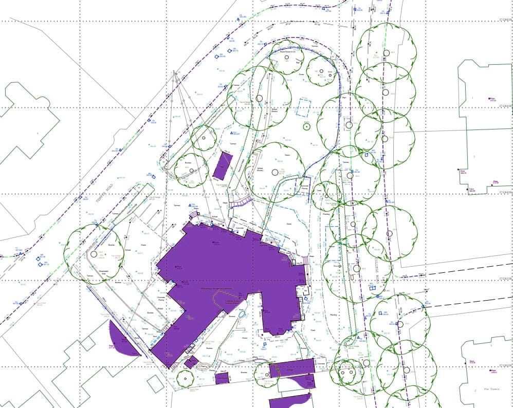
Purpose: Provide meticulous measurements and details of existing equestrian buildings and facilities. Applications:- Evaluation and adaptation of existing structures for equestrian use.
- Compliance check with equestrian standards and regulations.
- Planning for modifications or expansions of equestrian facilities.
- Delivers essential information for effective facility assessment and modification.
- Helps improve horse and rider safety and comfort.
- Aids in maintaining regulatory compliance and standards.
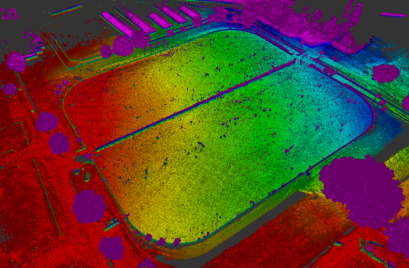
Arena Flatness Surveys:
Purpose: Provide precise measurements of arena surfaces to ensure optimal flatness and uniformity, guaranteeing the safety and performance enhancement of horses and riders. Applications:- Ensuring uniform and level surfaces for training and competition arenas.
- Identifying and addressing areas requiring correction or improvement.
- Aiding in the planning and construction of new equestrian arenas.
- Ensures the highest level of safety by reducing the risk of uneven surfaces, preventing potential accidents and injuries.
- Enhances the performance of horses and riders by providing consistent and even footing.
- Assists in maintaining and constructing arenas to the highest standards, contributing to an overall superior equestrian experience.
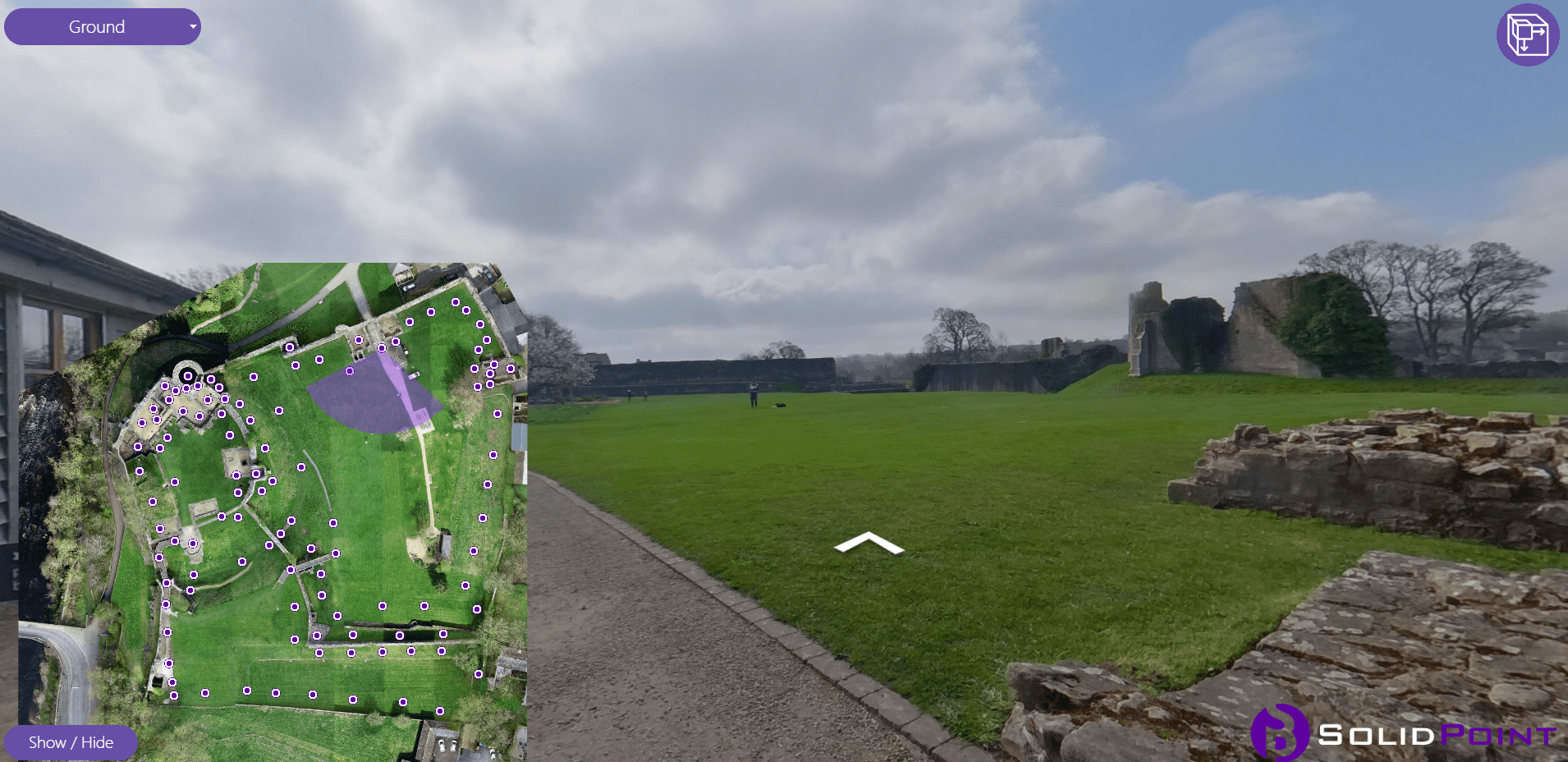
360 Tour:
Purpose: Offer a virtual, immersive experience of equestrian properties and facilities for remote viewing and assessment. Applications:- Virtual tours for potential buyers or investors.
- Remote assessment of facilities and spaces.
- Enhancing online presence and marketing of equestrian properties.
- Provides a unique and engaging view of equestrian facilities.
- Allows for remote, convenient viewing and assessment.
- Enhances the appeal and accessibility of equestrian properties to a wider audience.
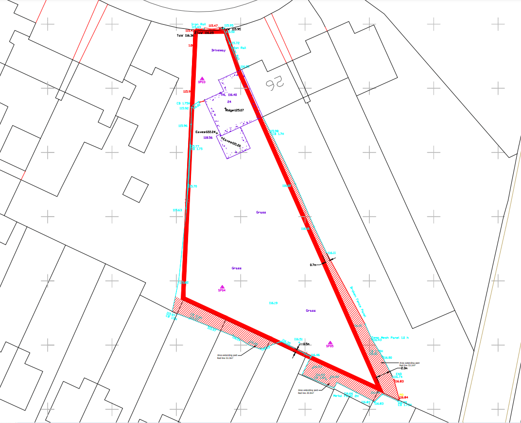
Boundary Surveys:
Purpose: Offer exact boundary data, facilitating clear demarcation of equestrian property limits. Applications:- Verifying property boundaries.
- Clarity in property ownership.
- Avoidance of property disputes.
- Provides key data for ensuring legal security in property ownership and use.
- Assists in preventing property disputes.
- Ensures secure and clear space for all equestrian activities.
Immerse yourself in the seamless blend of precision and equestrian mastery with our extensive range of services. Elevate your equestrian spaces to unparalleled heights of excellence and functionality. Join us at our trade stand at HOYS next week to discover more!
How Can SolidPoint Help Your Project?
At SolidPoint, we are passionate about providing accurate and efficiently collected data for our clients and have worked on numerous projects across the UK. If you are looking to employ drone surveying in your next project, please don’t hesitate to Get in touch with a member of our friendly team to discuss your requirements.
Alternatively, you can call us on 01332 898350 or email us at projects@solidpoint.co.uk for more information on our services. We look forward to hearing from you!
Give us a call on
