How To Commission a Successful BIM & Point Cloud Survey in 6 Steps
Do you currently have a project in the pipeline and are considering commissioning a point cloud survey to help produce a BIM Survey or intelligent Revit Project?
Then this blog could be the information you need to avoid falling into some of the common traps that can end up heavily delaying your project or costing your client unnecessary fees through the project.
Please read on to discover some best practices, questions to ask and some useful templates to help you ensure your project runs smoothly.
I think before completely diving into this blog, it is key to understand some of the terms in the title:
Point cloud: A point cloud survey consists of millions of accurate vector measurements captured using laser scanners. Or, produced through photogrammetry using multiple scaled photographs to accurately measure a subject.
BIM survey: A BIM survey is the existing state of a building or site, represented in a digital 3D format and produced using Building Information Modelling (BIM) software such as Revit, ArchiCAD or Vectorworks. Also sometimes referred to as “Scan to BIM” but I prefer the term “BIM Ready Survey”, as we prepare the existing data, ready for a BIM environment.
Now that these terms are clear, let’s begin:
How to Commission a Successful Point Cloud Survey and BIM-Ready Survey in 6 steps [Summary]:
Step 1: Establish the purpose of the survey information required
How will you use the information provided and does the surveyor understand this?
Step 2: Ensure the point cloud survey will perform as you require
The scan data needs to be accurate, capture everything you need and most importantly work on your machine.
Step 3: Define the level of detail (LOD) of the BIM Ready model
Describe each of the elements you require modelling, how to model them and the accuracy you need.
Step 4: Make sure that a quality assurance procedure is in place
You don’t want to waste time checking someone else’s work, so be sure that it has been checked thoroughly before hand over.
Step 5: Detail the requirements of the final deliverable
List the formats you require, the sheets and views you need producing, maybe you can’t wait for the final deliverable so need access to the BIM 360 project.
Step 6: Provide Feedback
If you want your surveyor to improve what they do and offer better value for money, it is essential you provide constructive criticism on their work, or simply tell them it is perfect, if you think it is.
Now let’s go into a little more detail!
I’m sure most people know that the key to receiving the information they need from a supplier is good communication.
This is completely true when it comes to ensuring a surveyor captures all the information required and delivers it in a presentable and timely manner. Therefore, enabling the designer to complete their tasks efficiently.
The Problem:
We regularly receive client briefs that list very detailed information regarding traditional measured building and topographical surveys. However, most lack detail with regards to laser scanning and Building Information Modelling (BIM), simply requesting “A Revit BIM survey” and a “Point cloud Survey”.
This leaves the quality completely open ended for the final delivery from the surveyor.
This can lead to some very poor survey information, meaning designers are either having to go back out to tender, putting projects months behind schedule. Or, completely abandoning BIM and returning to traditional 2D methods for the survey information.
The Solution:
In the hope to reduce under detailed requests and poor-quality survey information, I’ve decided to write this blog. It will explain the process of commissioning a successful point cloud and BIM Survey. It will cover example questions to ask the surveyor, ensuring they produce the required, well presented, reliable information.
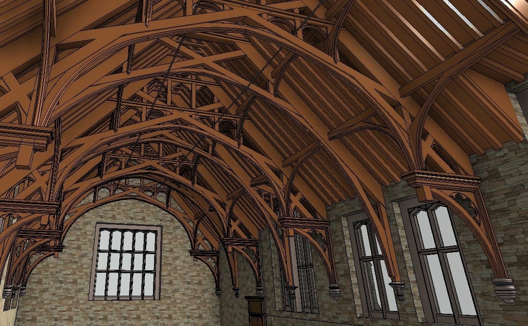
Step 1: Establish the purpose of the survey
This may be obvious to you as the designer, but unless the surveyor fully understands the purpose, they will likely miss vital information. They may not meet the accuracy, which can turn into huge costs during construction.
The nature of the proposed works will affect what information needs capturing, the level of detail modelled, and the accuracy tolerance adhered to. Here are 3 example projects where the scope greatly affects what information collected and modelled:
Example 1: Full commercial strip out and Refurbishment of a commercial building, including extension to the roof to provide 3 additional floors:
This requires a full measured building survey. The building will be gutted, so it may only be essential to capture data for the core structure. Ignoring internal partitions and ceiling voids. This can save on costs dramatically, requiring less time on site with reduced Revit Modelling times.
A higher accuracy tolerance and level of detail may be important for the roof area requiring the extension. Setting out from existing elements here will likely be crucial. It will also be helpful to understand what will be demolished or retained.
Another consideration will be the surrounding context of the building, simply measuring the subject building will not be enough.
A Rights to Light study may need to take place. For this a Rights to Light surveyor will require a reasonably accurate model of the surrounding to a specific level of detail. To add 3 additional floors, it may mean that all the properties within the vicinity facing the subject need surveying. Indicating window/door positions and ridge/eaves heights.
Example 2: Expensive Heavy mechanical equipment replacement within an airport baggage hall:
The key areas to survey here would be immediately around the equipment, but also potential routes taken to remove old equipment, to bring in the new.
Airports use equipment that can cost millions of pounds. So, ensuring the accuracy of the survey along the travel routes is important, especially around the potential pinch points. Such as; overhead steels and services that could clash with the equipment while in transit.
In this scenario it might be sensible to initially request a lower level of detail model to help establish the pinch points, then raise the level of detail in those areas to ensure higher accuracy without having to waste time and costs with extra accuracy and level of detail throughout the entire route.
Example 3: Full refurbishment of a ward within a hospital:
This may seem straightforward and like the first example, but the key to this is that it is only a small part of a large building.
Other areas of the building will likely require the services running through the ward. Due to this, to establish which services to retain or remove, ceiling voids will likely require surveying.
Colour lasing scanning may also be important within the voids, to help identify services, Yes As-built drawings may exist, but I’m sure any experienced engineer or contractor will tell you that they aren’t always reliable. The area may be 15-20 years old and lots of quick fixes and repairs have likely taken place without updating any drawings and even when they have, they are likely inaccurate.
Another consideration is the current use of the area, Surveying during visiting hours will likely be inappropriate and some areas will likely not be accessible due to bed positions or patient presence. Following decantation of the ward, some areas may require revisiting. But to ensure that most of the design work can take place beforehand reducing downtime of the area in the hospital, so capturing what is possible is important.
I could give many more examples as the list of bespoke projects we work on, or could potentially work on, is almost endless. But the key factor is that there can be a huge variety in the scope of a project. This can greatly affect what survey information to capture.
Start with low detail:
It’s good to remember that laser scanners measure everything they can see with potentially sub-mm coverage. Generally capturing more detail than a model will depict. So, it’s easier and cheaper to model a low level of detail initially from point cloud data. Then raise the level of detail in specific areas. Pulling additional information from the point cloud when necessary.
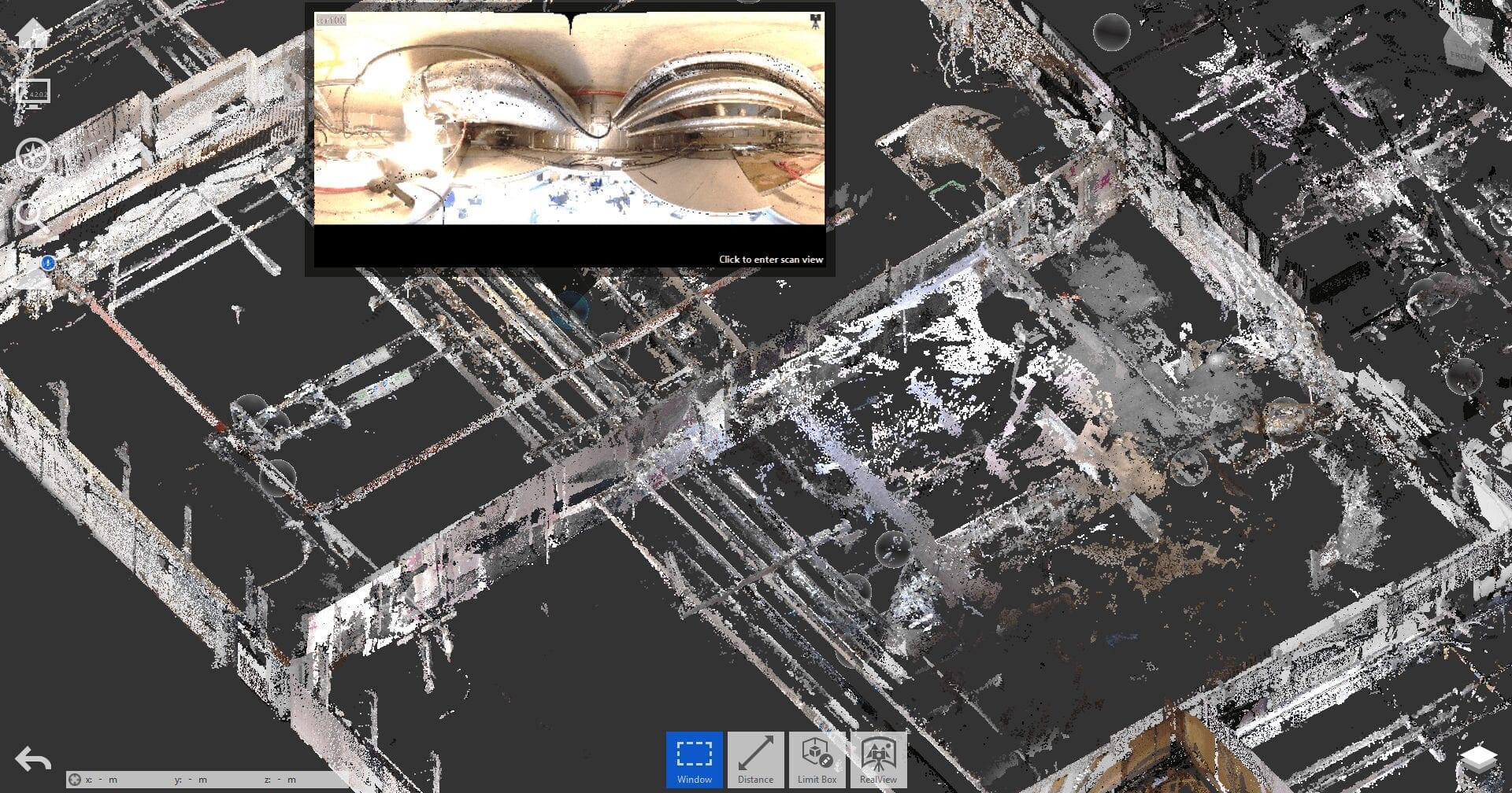
Step 2: Ensure the point cloud survey performs as you require
Simply requesting a “point cloud survey” will get you one, but there are a several questions to consider:
Can your BIM software import the point cloud survey data?
You need to make sure that the surveyor will deliver the information in a format you can use. If using Revit 2014 onwards you will require an rcp or rcs format, however if for some reason you are still using Revit 2012 or 2013 (please upgrade) you will require a pcg format. My clients that use ArchiCAD or Vectorworks tend to request e57 which opens well if cut into smaller parts or decimated.
If you can’t open the file in the software you use, or the surveyor can’t export to the required format, then the survey is almost useless. Unless of course you don’t need the point cloud or want to check the quality of the surveyors work!
Is the point cloud survey accurately aligned?
A finished point cloud of a building usually consists of hundreds, sometimes thousands of individual scan positions. The scanner creates an individual piece of the point cloud from each of the scanned positions. Aligning these pieces, creates the finished product. If done poorly, you will see duplication of objects where the data has been misaligned. This can lead to huge errors in the survey and risk of further errors throughout the design process. Ensuring an accuracy tolerance of the point cloud with the surveyor should remove this risk. For example, +/-15mm should be easy to achieve and would fall in line with RICS standards for a measured building survey.
Will the point cloud survey have a good enough resolution to capture the detail you need?
You may intend to use the point cloud to pick out finer detail, maybe to establish the positions of electrical or mechanical fixtures or fine architectural detailing such as ornamental carvings or ceiling moulding. You may be interested in conservation and want to record the erosion of a stone wall over a given period. If the resolution of the captured data isn’t high enough then this will not be possible.
You need to tell your surveyor the point density you require for the survey. Maybe 10mm, 5mm, 3mm or even 1mm or below. This will help them establish how much time they need on site. For example, to ensure 10mm accuracy means each scan will only need to take around 1 minute depending on range to the target, whereas to capture 1mm or lower may require more than 10 minutes per scanned position!
Will the points have RGB (colour) values to enable you to produce the beautiful visualisation you had planned?
This is simple, colour or not, or is it? If you consider that each scan requires approximately 3.5 minutes more on site and more time in the office processing the data. Requesting a full colour point cloud can increase the cost of the survey by around 40%. So instead try to decide specific areas where you need colour scans. You may only need the external of the building for visualisation purposes. Or, you need only a few key rooms within the building which need retaining for conservation purposes.
Will the point cloud survey capture all the areas you need?
In the past we have picked up clients that have fell out with their surveyor because they requested the Ground to roof level of a building surveying. When the surveyor didn’t capture the basement, the designer requested a return to site. The surveyor then presented the additional cost. It is an awkward conversation the designer then must have with the end client. To avoid this situation, it is much easier to clearly define all the areas requiring capture in the survey; like the examples in step 1. Well annotated existing plans of the property tend to work best, ideally with photographs of the area requiring survey.
Will you be able to work with the point cloud survey efficiently using your BIM software and hardware?
One big issue we hear about is that some designers don’t like point clouds because they are difficult to work with as they grind the hardware to a halt! This can be true but easily rectified if the conversation happens with a well-informed scanning surveyor. Importing a high-resolution point cloud to a project at full resolution, will almost definitely mean that it is difficult to work on, even with high-end specification computers. Instead you need to understand the capacity of the hardware and software you are working with so that the surveyor can decimate the point cloud to a useful amount.
We find that decimated the point cloud to around 20mm will allow decent processing on most machines (even laptops) and allow you to pick out most details. For areas where finer detail modelling is required it is better to clip that specific area of the point cloud and decimate to a finer resolution such as 3mm-5mm. this can then be loaded into the model as and when needed without making your desktop sound like a jet engine!
Will you be able to analyse the data from the scanned positions?
This can be very important! A 3D laser scanner will only measure what it can see, so being able to jump into the scan data from the capture position can help find things easier within the data. 3 examples of this are “real views” produced by Recap, “Tru views” produced by Cyclone and “Webshare” produced by Faro Scene. These all work in a similar way to 360-degree virtual tours and can be extremely useful when analysing the scanned areas and can bring excellent value for very little extra cost.
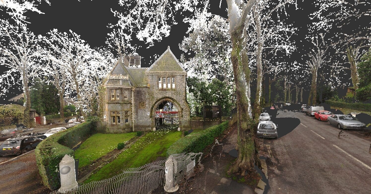
Step 3: Define the level of detail (LOD) of the BIM Ready project
You have likely heard of the LOD scale which broadly describes the creation and management of objects created in a Building Information Model. You may have even in the past asked for something to the tune of “A LOD300 Revit Survey”. This unfortunately isn’t an applicable way to specify the level of detail required for a BIM Survey. The scale identifies certain meta data of items needing inclusion. Gathering this isn’t possible from a non-intrusive survey without 3rd party data. It also doesn’t allow for the fact that areas of the survey may require a lower or higher level of detail depending on the scope of works.
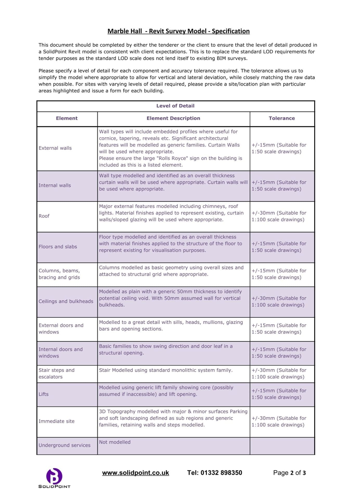
Instead of the LOD scale we have produced a specification which describes each individual element of a building, how it would be modelled in the BIM application and to what accuracy tolerance based on the point cloud data allowing for lateral and vertical deviation of the building.
As there are many ways to arrive at a solution when using BIM Software, it is good for the designer and surveyor to discuss the representation of elements. We find that different designers prefer different modelling practices. For example, Pavements could be topography or modified floors. Rainwater pipes could be pipes, generic category or site category. Cladded walls being simple walls or curtain walls. Each designer has their preference, which needs relaying to the surveyor early on to avoid additional costs.
Free to use template
Please feel free to use the following link to help you specify your survey requirements in a more appropriate way than using the LOD Scale:
Link to template using google forms
You will have noticed that these specifications are based on using Revit. This is because I personally have used Revit for around 10 years, and only have basic knowledge of its competitors. They should, however, give a good starting point for other software and hopefully if someone adapts it for use with ArchiCAD, Bentley, or Vectorworks for example, they will be happy to share it with us.
Useful Resource:
The RICS – Measured Surveys of Land, Buildings and Utilities – 3rd Edition
Step 4: Make sure that a quality assurance procedure is in place
The one thing we all hate as professionals is having to check that someone has done their job right. Surely it is better that you can rely on the information you receive, rather than having to spend the first week of your project’s time asking the surveyor to correct their work? There are things to look out for that flag up inexperienced surveying companies and potential ways that the surveyor could be quality assuring the work themselves.
Poor Quality modelling practices
This is where a lot of surveying companies fall short of standard! We have seen a fair few BIM Survey projects fall way behind schedule, cause major issues on site resulting in abandoning BIM and resorting to traditional 2D measured surveys. This is mainly because of a poor QA through lack of experience with the software and the designers required modelling methods (see step 3).
We regularly find plenty of surveying companies who can collect reasonable point cloud survey data from their laser scanners. But lack the capability to post process this data into an intelligent BIM Ready digital twin architectural model. Some of these companies use us or other well-versed companies to process their data with success. But many are still trying to find the cheapest alternative!
We have lost projects in the past to one of the many worldwide “scan to BIM” companies. It then lands back on our doorstep months down the line, with a very broken and worn looking Revit model. “Can you fix this” is a common term we hear. If the work is to be subcontracted, the company need to understand how to quality assure the work they receive before delivering to the designer.
A few tell-tale signs of a poor model are:
- Many “model in-place” elements – imagine you wanted to add 3-4 different material properties to the elements that make up the roof structure to find that every piece of wood is its own model in place element! 1000s of individual pieces weighing down the model. Good look trying to work with those.
- Walls modelled off axis – Sometimes it is important to model a wall slightly “off axis”, as it may affect the design. However, we have seen projects modelled by others where there isn’t one wall which is parallel/perpendicular to another. We checked, modelling “on axis” could easily be achieved by rotating walls less than 0.01 degrees!
- No Sheets, useful views or project location set. This is a prime case of getting what you ask for, a Revit model! wouldn’t it be better to have the project in a state that is truly BIM Ready?
- Poor categorisation – Some companies may have gotten past modelling everything in place, but only as far as creating everything as generic families, no nesting, no function with other elements, and most importantly poor for scheduling.
It is likely the person modelling has decent knowledge of 3D modelling but doesn’t know how to correctly apply it when using Revit or BIM.
How I believe a project should be quality assured:
Anyone who has tried to model a building from point cloud survey data will know that it is a difficult task to know where to stop in terms of level of detail and when to accept “that is close enough”. This is where the specification comes into play (assuming one exists). It allows us to run thorough checks on the model ensuring that it meets the specification’s requirements.
To do this we create a grid of sections with small view ranges of 50mm through the building ensuring that we cross all the major junctions of the building. By switching the point cloud to a solid bright colour and turning on transparency for the modelled objects we can quickly see and highlight any errors which need addressing.
We also run through Revit’s “Show related warnings” to remove as many as possible that do not affect the survey.
Creating quick schedules ensures that things aren’t categorised incorrectly. As we create all our own content rather than hunting through Revit City or other libraries, we know that this needs little checking.
Due to the nature of a BIM survey, it is extremely difficult to ensure you remove every potential error. However, we believe that we should at least try to give enough time. This is one critical thing the designer really should check with the surveyor: “Have you allowed any time for Quality Assurance?”
Step 5: Detail the requirements of the final deliverable.
I’m a firm believer in that if the surveying company is tasked with the existing survey of the building, they should complete the existing phase so that it is ready for further development of the project. It doesn’t mean that they should complete the 3D geometry and simply hand that over to the designer.
Survey Expectations and Results
It’s important to relay your expectations over to the surveyor so that the work they deliver doesn’t slow your project down before the work you need to do begins. For example, if we know that the initial purpose of the project is to help achieve planning permission for a roof extension. We will make sure that all the relevant views are set up in the project and inserted into sheets. This includes all the elevations, floor plans and sections through the building. We would even purchase the OS licence in .dwg format insert it into the model and red line the boundary for a site location plan at 1:1250 or 1:2500 scale. The aim is to allow the designer to get on with what the work they enjoy rather than having to tidy up the work of the surveyor. If you require more specific views, such as reflected ceiling plans or internal elevations. The surveyor should be aware so that they can allow enough time to create and present them.
Future proofing content
Will you need to reuse the families produced in the existing model for your own proposals? if so maybe it is worth asking the surveyor to spend a little more time building in required intelligence and parameters when producing the bespoke content for the model.
Doing this could save many hours, as anyone knows it can be a painful experience when it comes to creating parametric content that works well. We create 1,000’s as I’m sure any of our good competitors do as we regularly find on every project, we do that something new needs producing as it is slightly different to every building we have modelled previously.
It is also worth considering who else might use the project aside from the design team. There might be a structural designer who requires an IFC export as they use a more specialised version, a Rights to Light surveyor who requires a dwg in ACIS solid format for the software they use, or an interior designer that requires a Sketchup export as their furniture library exists solely in Sketchup. Exporting can require additional licences and takes time to produce and check, so needs considering in timescales.
Point Cloud Survey Data Handling
How do you want to receive the data? I’ve seen projects run days, sometimes weeks behind schedule because delivering the data wasn’t properly considered! Point cloud file sizes can be huge!
Our smallest projects tend to be around 10GB, with our largest projects pushing well into the 100s of Gigabytes. We tend to prefer to use Google Drive as we can allow people easy access and sharing. However, we are lucky enough to have unlimited 1GB/second upload and download speeds, whereas some of our clients do well to achieve 10MB/second in their areas.
This could mean that transferring a large file could take many hours assuming a stable connection. In these scenarios we tend to arrange sending relevant files on USB or even on external Hard drive for larger projects.
Collaborative Working
Do you require access to the BIM 360 project, so you can pull the information you need from the model as its produced?
This can give designers a big head-start in the project instead of having to wait 8-10 weeks for model completion, they can jump straight into it from the modelling of the first wall. This can also aid with communicating how you need the model to perform and can help guide the surveyor in the practices you prefer, as you can watch the almost live production.
If you are not interested in using BIM 360 for whatever reason, maybe you need information providing in phases so that you can get on with your task a little earlier.
Step 6: Provide Feedback.
To me as a business owner and technician, feedback is the most important thing. It’s great to be in a world where I truly believe that everything I do is perfect. However, to think that’s the case is delusional.
I’ve found that various clients work in different ways and have various preferences with how they like to model or even name things. We are the same, we try to establish the most efficient and tidiest way of producing and delivering our Revit Models and Scan data. However, we can likely improve in ways we haven’t yet discovered.
Constructive Criticism
By providing feedback in the form of constructive criticism on the model and methodologies used to produce it, the surveyor can improve their workflow to deliver better end products. This will likely save you time during your phase of works and add more value to your project overall. A few examples of useful feedback we’ve received in the past are:
- Include a “survey notes” parameter to help schedule modelling intent.
- Model inaccessible areas as 10mm walls with a “surveyed side” layer to iterate assumptions.
- Model the immediate pavement around a building as a modified floor with slab edges instead of topography to improve visualisations.
These are great examples of feedback, which we implement to improve the quality of output delivered to our clients.
Conclusion
The key to receiving a successful 3D Laser Scan, point cloud survey and BIM Survey is quite clearly good communication and good understanding from both the Surveyor and Designer. of what needs producing and most importantly, how to go about it.
If you’d like to arrange a meeting to go through your next project and ensure that the deliverable meets your expectations, then please feel free to give us a call, so we can discuss your project in more detail:
Stay updated with us:
How Can SolidPoint Help Your Project?
At SolidPoint, we are passionate about providing accurate and efficiently collected data for our clients and have worked on numerous projects across the UK. If you are looking to commission a survey in your next project, please don’t hesitate to Get in touch with a member of our friendly team to discuss your requirements and get a free quote.
Alternatively, you can call us on 01332 898350 or email us at projects@solidpoint.co.uk for more information on our services. We look forward to hearing from you!
Give us a call on
Request a Free Quote





Trusted Suppliers for:
