Buried Obstruction Survey – Pear Tree Primary School
Written by J. Jackson | Published: 9th September 2024
We were contacted by Pear Tree Primary School to conduct a buried obstruction survey as a precaution before they began excavation.
Our findings from this survey will allow our client to plan around any underground utilities and gather accurate costings for working around them.
What Is a Buried Obstruction Survey?
Buried obstruction surveys allow us to see what’s lying underground without the need for digging an area up and potentially causing damage to the scanned surface or the buried objects.
These surveys allow us to identify any buried obstructions early, avoiding any surprises that will cause delays further into the project.
How Does It Work?
To conduct buried obstruction surveys, we use a Ground Penetrating Radar (GPR). GPR’s are a non-destructive, non-intrusive detection and imaging method that identifies subsurface elements that are either underground or within surfaces – for example, within concrete.
The GPR sends a radio signal to a surface and reads the ‘bounce’ (the time the signal takes to return back to the GPR). This ‘bounce’ indicates the distance between the underground surface and the GPR.
What Did We Do?
Using GPR technology, we collected information at 0.5m intervals of the areas highlighted in the 1938 map and processed the data to look for anomalies in the ground.
To interpret the data, we used historic maps and the GPR data collected on site. This data was then extracted into CAD and any patterns or clumps of data were grouped together with an average point depth identified.
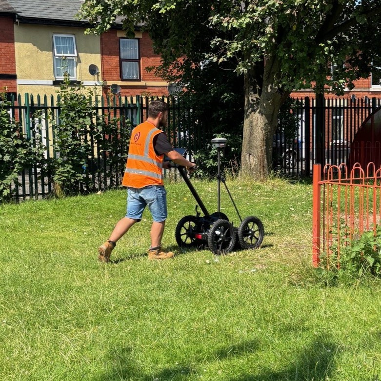
Ground Penetrating Radar (GPR)
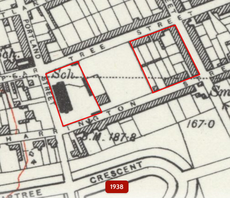
Map of the site, 1938
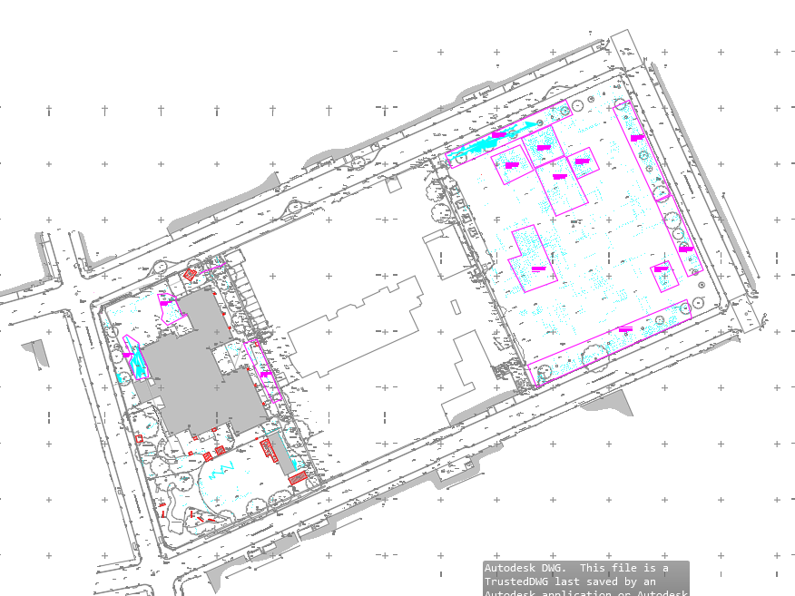
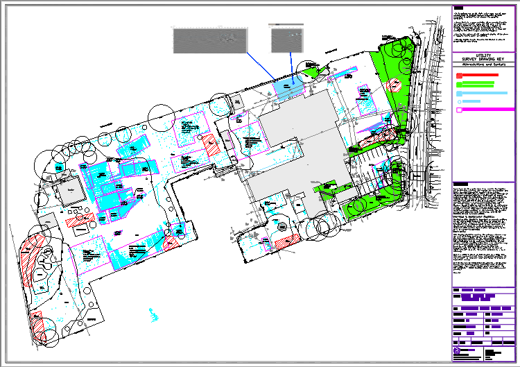
Final Drawing
On the final drawings, the client can easily see:
- The average point depth of data
- Anomalies in the data
- Hyperbolas in the data
This is important for the client as it will help them gauge how deep they need to excavate and where heavy duty excavation equipment will be required, which is vital for estimating costs of the excavations.
We have found that the anomalies found are consistent with the historic maps, and that there seems to be a pattern of a large slab/foundation left in place where houses were, at about 500mm deep.
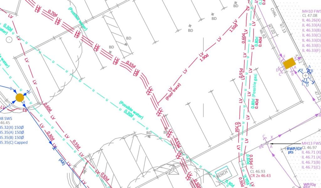
The information we’ve gathered, paired with a utilities survey we’ve previously conducted, will give vital information to the designers on what is happening underground so that they can plan around it and get accurate costings.
For More Information About Buried Obstruction Surveys:
Understanding: Buried Obstruction Surveys
Case Study: Becket Primary School
Stay updated with us:
How Can SolidPoint Help Your Project?
At SolidPoint, we are passionate about providing accurate and efficiently collected data for our clients and have worked on numerous projects across the UK. If you are looking to commission a survey in your next project, please don’t hesitate to Get in touch with a member of our friendly team to discuss your requirements and get a free quote.
Alternatively, you can call us on 01332 898350 or email us at projects@solidpoint.co.uk for more information on our services. We look forward to hearing from you!
Give us a call on
Request a Free Quote





Trusted Suppliers for:
