Aerial Drone Survey – Apartments in Sheffield
Our CAA qualified drone pilots are great at capturing accurate Aerial Drone Survey data and imagery. But can we extract more value out of the data we collect, to deliver additional time and cost benefits to the client?
Written by J. Pegg | Published: 10th July 2020| Updated: 4th September 2024
The scope
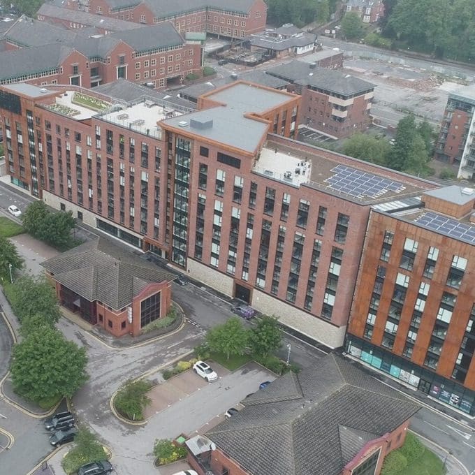
Our task was to capture aerial imagery of this new build apartment building in Sheffield.
The client’s brief was straightforward: “We want a short drone video to use in our new marketing campaign”.
If you’ve ever worked with us, you’ll know we’re passionate about getting the most value we can out of technology. So, our general aim is to see what added value we can bring from the data we collect. We set out to see if we could capture reasonably accurate drone survey data that could have multiple uses and bring immense value from the 1 hour we spent on site.
What to capture in the Drone Survey
The client had shown us some of their previous marketing campaigns to show us their expectations. It came in the form of roughly 5 seconds orbiting the building, 5 seconds flying towards the building. They also said they wanted to capture the roof terraces which would be a key selling point to the potential residents.
To achieve this, we captured multiple orbits and flights on various exposure and shutter settings. In total capturing roughly 40 minutes of footage, including high resolution still images and 4k videos. We then cut short segments to provide the clients with the best 30-40 seconds of raw data, perfect for further editing in their own video.
Drone Survey to Accurate 3D Model
So, we had met the clients brief, but what more could be achieved? Coming from an Architectural/surveying background I wanted to see if we could quickly produce an accurate 3D model from the data which would further expand its uses.
If we could produce an accurate 3D model of the buildings and its surroundings, the one hour on site would mean we could quickly capture and deliver valuable information for uses such as:
- Feasibility Studies
- Planning Applications
- Basic Topographical Surveys
- Rights to Light Analysis
- Detailed Roof Inspections
- Conservation Records
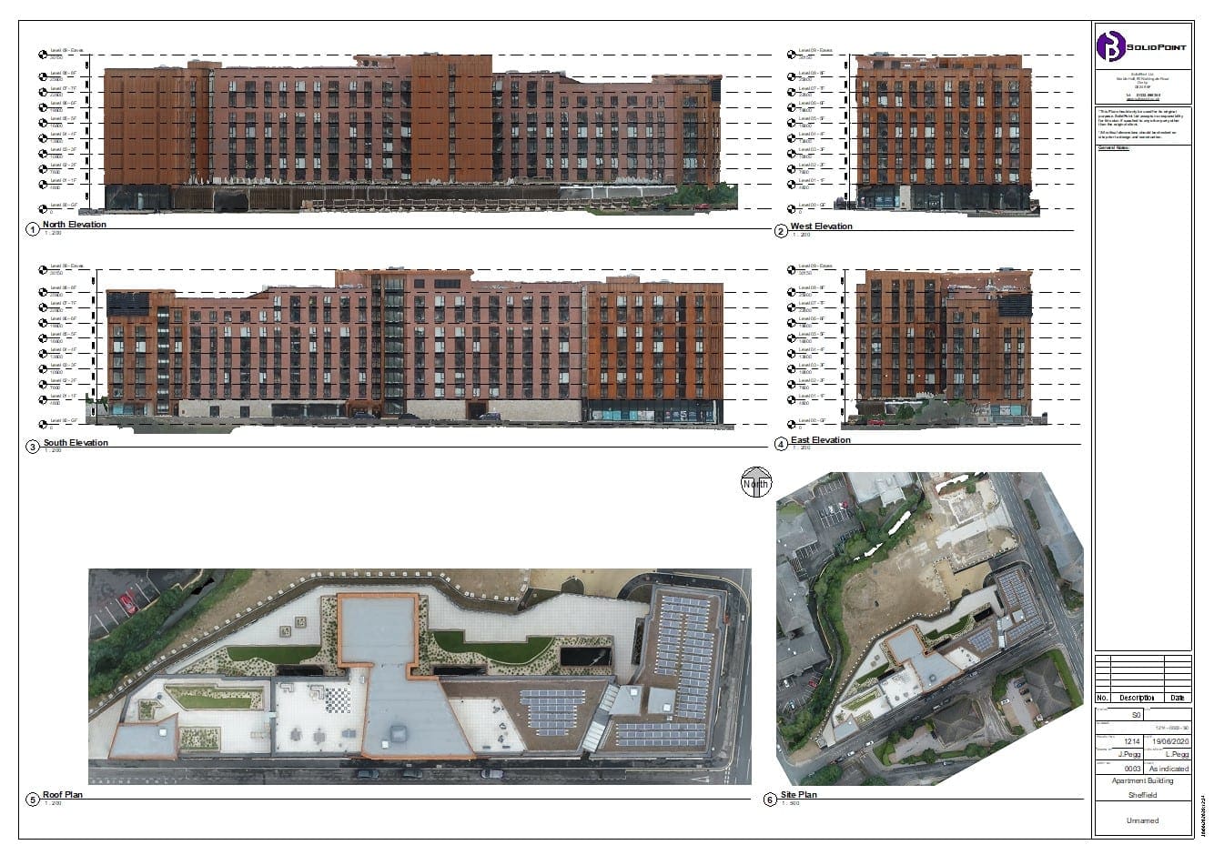
By using photogrammetry methods, we were able to piece together the photographs captured by the drone to produce a detailed 3D mesh model. Utilising the laser scan data from ground level we could accurately scale the 3D model.
To be able to meet the full list above, it was also essential to accurately position the information using GPS. Our Drone is set up to capture its GPS position precisely at the time of image capture. By applying an average of these positions to the calculated position of the image, we can place the site to accurately position the whole model in its correct GPS position.
Making use of the accurately positioned 3D Model
We wanted to be able to extract working information from the model, so set about extracting:
- Orthographic Elevations to an accurate scale.
- Orthographic Site and Roof Plans
- Point Cloud Data to help produce an intelligent 3D BIM
- 3D Digital Terrain Map (DTM) and Contours
- Accurately Coloured and Textured 3D mesh
All this information would be the foundations of the previous use cases.
Conclusion
Our aim was to not only meet the clients brief but see if I could bring additional added value within a short period of time on site. I believe that within 1-hour access to a site of this size, we can capture the basis of any design and development project. This will massively reduce timescales, costs and any assumptions associated with a project, while delivering massive amounts of information which previously may have been outside the project’s time and cost budget.
If you would like to talk to us about capturing a Drone Survey for your project, or to ask if we could meet your use case, then please get in touch with us.
We’d like to thank our Clients Bradgate Estates & Grainger PLC for giving us access to their property to run these tests on Brook Place Apartments.
Stay updated with us:
How Can SolidPoint Help Your Project?
At SolidPoint, we are passionate about providing accurate and efficiently collected data for our clients and have worked on numerous projects across the UK. If you are looking to commission a survey in your next project, please don’t hesitate to Get in touch with a member of our friendly team to discuss your requirements and get a free quote.
Alternatively, you can call us on 01332 898350 or email us at projects@solidpoint.co.uk for more information on our services. We look forward to hearing from you!
Give us a call on
Request a Free Quote



Trusted Suppliers for:
