Royal Cambridge Hotel Measured Building Survey
The hotel would be live at the time of survey, yet every room needed measuring.
The initial request was for 2D Plans, sections and elevations of the building to aid them with a planning application.
Written by J. Pegg | Published: 29th June 2020| Updated: 4th September
The scope
Due to the building being fully functioning, we needed an approach that meant we could quickly capture the bedrooms correctly without needing a re-visit. Low resolution, grey-scale, 3D Laser scanning was the obvious choice to produce an accurate point cloud survey we could analyse in Revit.
To ensure the client has a full record of the materials and condition of the rooms, we opt to use a 360° camera instead of static photographs. This gives us high resolution imagery in a simple click and drag viewing environment.
Much of the roof area is inaccessible, and difficult to view from ground level. So, we chose an aerial drone survey to provide visual roof inspection data. This data will also be valuable when determining the roof plan and the condition and position of the roof elements.
Laser Scanning to create a Point Cloud Survey:
As most of you know, and all our clients know, we always deliver the point cloud we produce.
We believe in allowing our clients the opportunity to not only inspect the building in intricate detail (if they have the desire to do so., but also have the opportunity to see how we have interpreted the data.
On this occasion, as with most, we provided the point cloud data in rcp format, meaning they can analyse for free in Autodesk Recap and can import to most Autodesk applications such as Revit or AutoCAD.
When we deliver the Revit Survey information, the Point Cloud is pre-linked and can easily reload at the client’s end.
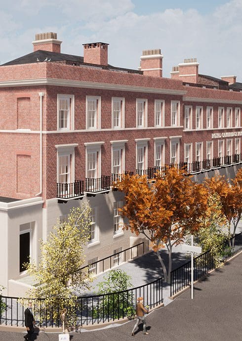
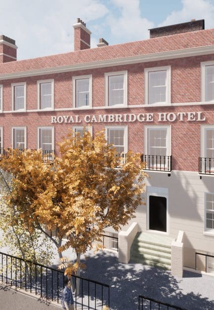
BIM-Ready 3D Revit Model
Naturally, the only way we were going to tackle this building was in 3D, and in an intelligent, BIM-Ready format. So, a “Measured Building Survey” request, immediately became a “3D Measured Building Survey” request for us. We made the decision to create an intelligent digital twin of the building in Revit. Therefore, reducing the workload when it came to producing area reference plans, Sections and Elevations, which would prove essential for the client. Producing this intelligently using our own in-depth knowledge of Architecture and construction, meant we could reverse engineer the building. This allowing the Architects to concentrate on their design work, knowing the existing phase was reliable and functional.
Aerial Drone Survey
As with everything else we try to take Aerial photography (Aerial Drone Survery) to the next level. Rather than simply taking a few pictures from 100’s of meters away and handing over 5-10 images of the building. We like to get up close and personal with it. Firstly, authority from the local CAA and airfields would ensure safe flying around the hotel. We then flew within 5m of the building’s Roof chimney and Walls to create a 4k Video of every little detail, picking out every default we could find along the way. This was captured in just a few hours but would provide a massively valuable source of information to the designers and building owners.
Conclusion
We believe our team provided an exceptional 3D Building Survey of The Royal Cambridge Hotel. We delivered output that far exceeded our client’s expectations of simple 2D survey information. The data we capture will deliver valuable insights into the building, not only through the design phase but when any construction work begins. It will reduce waste, by enabling reliable decisions und reducing duplicated efforts.
I’m sure you’ll agree with us, that providing a 3D Measured Building Survey is also far more appealing and much easier to understand than its traditional 2D counterpart.
If you think that your project will benefit from a 3D Measured Building Survey too – then please get in touch. We would be happy to deliver a more in-depth demonstration, or can advise on how to best approach your project and add almost priceless value for you and your client.

Stay updated with us:
How Can SolidPoint Help Your Project?
At SolidPoint, we are passionate about providing accurate and efficiently collected data for our clients and have worked on numerous projects across the UK. If you are looking to commission a survey in your next project, please don’t hesitate to Get in touch with a member of our friendly team to discuss your requirements and get a free quote.
Alternatively, you can call us on 01332 898350 or email us at projects@solidpoint.co.uk for more information on our services. We look forward to hearing from you!
Give us a call on
Request a Free Quote



Trusted Suppliers for:
