St. Paul’s Cathedral, London
Measured Aerial Drone Survey
Written by J. Jackson | Published: 5th April 2024 | Updated: 5th September 2024
Our team was contacted to carry out a measured survey of the exterior walls and the roof of St. Paul’s Cathedral by their Property Management team, to assess whether there is any damage to the cathedral, and to what extent that damage is. To do this, we conducted an aerial drone survey in order to ensure that we captured every detail on the building.
Why a Drone Survey?
The purpose of a drone survey is to generate high-resolution orthomosaics and 3D models of areas where there is only low-quality, outdated or no data at all available.
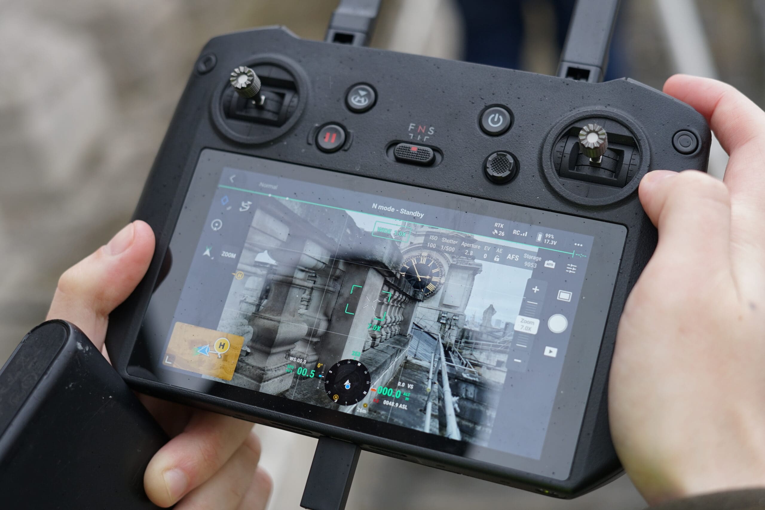
A drone can capture data over a large area in a short time with ease in areas that are traditionally harder to reach, such as roofs, without the need for scaffolding or machine lifts, therefore allowing for a more efficient survey to be completed.
For example, during this process, our drone took over 11,000 pictures over a 16 hour process!
These pictures were then loaded into our software and placed onto a 3D plane, which we then used to construct our model.
High-Resolution Imagery From Our Drone

Extract From the Final Model
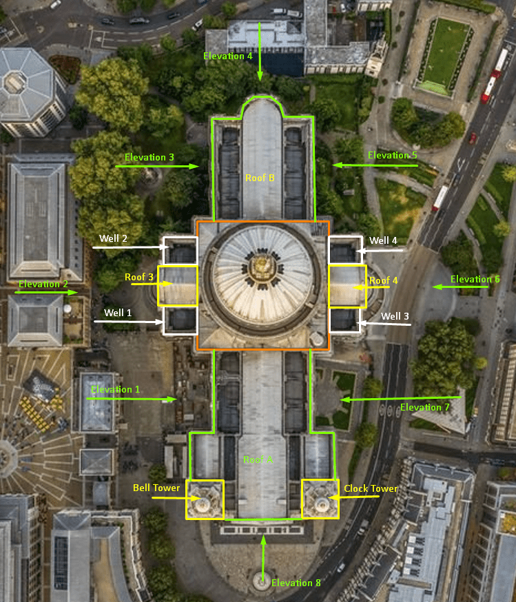
Breakdown Image
Once we processed all data, we created a breakdown image that allows our client to refer to and locate where the images were taken as they receive the image stills.
We do this because feedback has indicated that pinpointing which area an image is from can be difficult without a breakdown reference to refer to.
Benefits of a Cloud Based Model
- They provide easy sharing access for stakeholders
- They provide easy documenting of any defects present and remedial work needed
- They reduce cost, time and the carbon footprint of visits to the site for contractors
- They aid in planning discussions
- They can be used to scale the cost to suit any budget by using the detail captured
Extract from the Final Model
Our client received a full Cloud Based Model of the building. They have full navigation access so they can pin-point whichever area they wish to look at, and select an area to see details (as shown).
Stay updated with us:
How Can SolidPoint Help Your Project?
At SolidPoint, we are passionate about providing accurate and efficiently collected data for our clients and have worked on numerous projects across the UK. If you are looking to commission a survey in your next project, please don’t hesitate to Get in touch with a member of our friendly team to discuss your requirements and get a free quote.
Alternatively, you can call us on 01332 898350 or email us at projects@solidpoint.co.uk for more information on our services. We look forward to hearing from you!
Give us a call on
Request a Free Quote




Trusted Suppliers for:
