Swindon College
Measured Building Survey
Cost-effective, High-Resolution Aerial Inspection, 3D Digital Twins and Imagery
Full Measured Building Surveys for Two Buildings at Swindon College
Written by J. Pegg | Published: 27th October 2018 | Updated: 4th September 2024
The scope
Two buildings at Swindon College; Corvus and Pegasus, required a full measured building survey to act as the starting point for renovation design work to take place. The Architects commissioned for the design work use ArchiCAD frequently, so requested the data in an industry standard intelligent 3D IFC format that could be imported into ArchiCAD. As they are familiar with analysing point cloud data, they also requested this in a working E57 format.
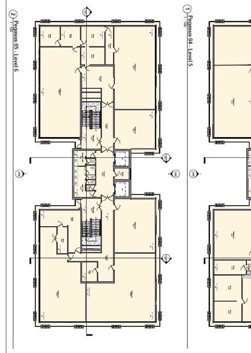
A standard measured building survey is also traditionally delivered as 2D plans, sections and elevations. Although the Architects were working in a 3D BIM format, they still required 2D plans as quick reference and of course to issue as part of a planning application. So, these were high on their priority list.
On Site Laser Scan Survey
The Pegasus building was a 7 Storey live building including an accessible Roof, with the Corvus building only being over 2 stories. In total we collected around 850 scan positions to fully capture both buildings over a 3-day period. As the building was live we had to coordinate carefully with the staff to ensure we didn’t disrupt their lessons unnecessarily.
Each laser scan positions data was then pieced together to form a fully functioning point cloud that could easily be analysed in Autodesk Revit, AutoCAD and Recap for our own purposes and then exported E57 format, so the client could import the data into ArchiCAD.
BIM Ready Measured Building Survey
The next phase of the project was to reverse engineer the buildings in a BIM ready format. For this our preference is to work with Autodesk Revit, directly modelling from the coordinated point cloud data. By carving thin slices through the point cloud, we can model accurately to a given tolerance, in this case +/-10mm to allow for any potential deviation in the building.

With all our projects we like to keep them intelligent, so we create fully parametric custom families for the doors, windows, curtain walls, external detailing and any other item which we thought needed a little extra attention to detail. Our clients hugely benefit from us working in this way as they can easily schedule, phase and re-use the content we produce adding any meta data easily by type or instance that they find useful.
As with any project, this one needed to be completed to a strict program of 3.5 weeks, ensuring that we could issue vital information to the Architect along the way, so that they could complete their tasks on time. Usually we would work on a collaborative cloud platform hosted by ourselves so that we can work collaboratively with designers on a live model. But in this situation, our clients were using a different software, which meant we needed to adapt our usual delivery of information. By exporting regular IFC updates and 2D views we could easily keep the Architects well fed with information, so they could stay on schedule.
Conclusion
Overall, we are pleased with the outcome of this project. We have pushed the quality of the delivery to another level when compared to previous projects and have adapted to the needs of a client working on a completely different software using industry standard formats such as IFC for 3d model collaboration, E57 for laser scan data analysis, and PAS-1192 layering standards for dwg outputs.
One delightful comment we had from our client was:
“We didn’t realise that a survey company could produce an intelligent 3D survey, we have only received dumb 3D geometry in the past. Knowing this will save us weeks of effort on projects as we would normally create the 3D model ourselves from the surveyors 2D information, The IFC exported from Revit, imported to ArchiCAD beautifully with all items categorised as we would expect. Thank you for your efforts and we look forward to working with SolidPoint on future projects”
We’re looking forward to pushing our standards even more, hopefully something of a similar nature comes our way soon.
Stay updated with us:
How Can SolidPoint Help Your Project?
At SolidPoint, we are passionate about providing accurate and efficiently collected data for our clients and have worked on numerous projects across the UK. If you are looking to commission a survey in your next project, please don’t hesitate to Get in touch with a member of our friendly team to discuss your requirements and get a free quote.
Alternatively, you can call us on 01332 898350 or email us at projects@solidpoint.co.uk for more information on our services. We look forward to hearing from you!
Give us a call on
