Aerial Drone Surveys | Peterborough
Precision Aerial Drone Survey Services for Peterborough’s Rapid Development and Environmental Monitoring
Embracing Advanced Drone Survey Technology
Peterborough, a city experiencing rapid growth and expansion, requires precise and effective surveying solutions. SolidPoint offers state-of-the-art aerial drone survey services, utilising advanced drone technology to provide critical aerial data that supports development projects and environmental monitoring throughout the area.
Learn about the UK Drone Regulations, discover a list of 6 Things Every Drone Pilot Needs, and more on our blogs page.
What Is an Aerial Drone Survey?
Aerial drone surveys involve using drones equipped with high-resolution cameras to capture comprehensive images and data from the air. This innovative surveying method provides a unique aerial perspective that is invaluable for developers, planners, and environmental scientists in Peterborough who need to oversee large-scale projects and monitor environmental impacts effectively.
Certified Drone Pilots at Your Service
When you choose SolidPoint, you’re not just opting for a service—you’re investing in peace of mind. Your project benefits from CAA (Civil Aviation Authority) certified Drone Pilots boasting over 500 successful flights. We continuously invest in the newest technologies, guaranteeing the most accurate data for your project and crafting workflows tailored exclusively for you.


In a rapidly evolving digital age, the Drone Survey technology stands out as a game-changer for inspections and aerial photography.
Searching for a safe way to inspect difficult-to-reach areas or capture stunning imagery of properties?
Look no further. Here at SolidPoint, we harness the power of this cutting-edge technology, operated by certified professionals. Our specialists deliver services tailored to your needs, capturing precise data swiftly and safely.
With a rich history in surveying, we pride ourselves on our team’s unparalleled proficiency in operating UAVs (unmanned aerial vehicles) for commercial purposes. SolidPoint is more than just a service; we’re a commitment to excellence.
Projects we support in Peterborough
Urban and Rural Development: Optimise planning and implementation of both urban expansion and rural development projects with accurate aerial data.
Environmental Conservation: Monitor environmental areas effectively, assessing impacts and maintaining the ecological balance.
Agricultural Management: Support efficient agricultural practices through precise land and crop monitoring.
Infrastructure Assessment: Facilitate the planning, development, and maintenance of infrastructure with detailed, regular aerial updates.
How Much Does a Drone Survey Cost?
For projects in and around Peterborough, the cost can be as low as £750 + VAT for a small sized plot. The price may increase depending on distance, size, and the level of detail required to record what you need.
Calculate your own quote for 3D Drone Surveys, LiDAR Surveys and Thermal Imaging!
The app will open in a new tab. Please note that the prices you receive will be an estimate for a survey with a medium level of detail, and we will have to conduct our own assessment of the area before confirming the final price.
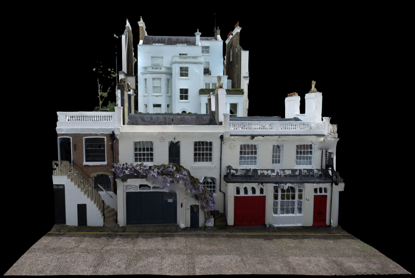
With a Medium Level of Detail, your 3D Drone Survey will look like this:
Benefits of an Aerial Drone Survey
In today’s construction and real estate landscape, having granular, precise data has never been more essential. For effective refurbishments, having comprehensive data is paramount. Whether you’re a designer, contractor, or facility manager, making informed decisions is crucial. Aerial drone surveys bring you unparalleled perspectives, transforming challenges into solutions. From pinpointing leaks causing property damage to understanding the intricacies of an unreachable roof, aerial drone survey inspections are the optimal way to gather necessary data.
Drone surveys represent a modern, efficient, and safer alternative to traditional surveying methods, bringing a new level of precision and accessibility to various fields.
Inspection data highlights include:
- Roof damage assessments
- Inspections of hard-to-reach or inaccessible areas
- Surveys of potentially hazardous buildings
- Land contour and elevation assessments
- Building facade condition surveys
Why Choose SolidPoint for your Peterborough Projects?
Customised for Peterborough:
Our drone surveys are specifically designed to meet the unique developmental and environmental needs of Peterborough.
Superior Image Quality:
We provide ultra-high-resolution aerial photos and videos, which reveal details that are crucial for precise planning and monitoring.
Cost-Effective and Efficient:
Drone surveys streamline the data collection process, offering a faster and more economical alternative to traditional methods.
Minimal Disruption:
Drone operations are conducted with minimal impact on the surrounding environment and daily operations, making them ideal for busy or sensitive areas.
Versatile Applications:
Whether it’s aiding in the development of new housing projects, managing agricultural lands, or monitoring natural habitats, our services are adaptable to a wide range of needs.
Swift Data Delivery
In our digital age, time is of the essence. At SolidPoint, we understand that speed doesn’t have to compromise quality. Usually, data collection wraps up within a day. With our advanced processing tools and dedicated team, expect processed data ready for electronic delivery by the next day.
Economical Choice
Aerial drone surveying isn’t just about cutting-edge technology—it’s also about cost-effectiveness. A smart alternative to traditional methods like scaffolding or machine lifts, it offers superior views without the hefty price tag. It’s cost-effective, free from height restrictions, and quickly deployable. Plus, our advanced drones ensure that weather or cloud cover won’t compromise the results.
Minimal Interruptions
Your daily operations matter to us. Our team carefully plans each project, designating a remote take-off and landing zone, distant from main entrances and foot traffic, ensuring zero disturbances or potential harm. With SolidPoint, enjoy a seamless, professional experience every time.
Take a look at some of our projects:
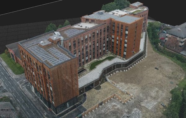
Case Study: Sheffield Apartments
Case Study: St. Paul’s Cathedral

Get Started with an Aerial Drone Survey in Peterborough
Advance your projects with our cutting-edge aerial drone technology.
Contact SolidPoint today to arrange a consultation and discover how our drone surveys can provide the detailed aerial insights necessary for successful project management and execution in one of England’s rapidly growing cities.
Some Areas We Cover:
Birmingham
Bristol
Burton-on-Trent
Chesterfield
Derby
Hull
Leeds
Leicester
London
Manchester
Nottingham
Peterborough
Sheffield
Stockport
York
Stay updated with us:
How Can SolidPoint Help Your Project?
At SolidPoint, we are passionate about providing accurate and efficiently collected data for our clients and have worked on numerous projects across the UK. If you are looking to commission a survey in your next project, please don’t hesitate to Get in touch with a member of our friendly team to discuss your requirements and get a free quote.
Alternatively, you can call us on 01332 898350 or email us at projects@solidpoint.co.uk for more information on our services. We look forward to hearing from you!
Give us a call on
Request a Free Quote




Trusted Suppliers for:
