Topographical Surveys | Birmingham
At SolidPoint, our surveyors are devoted to producing first class Topographical Services to provide you with with accurate measurements of your land.
Surveying your Land and property with the latest technology
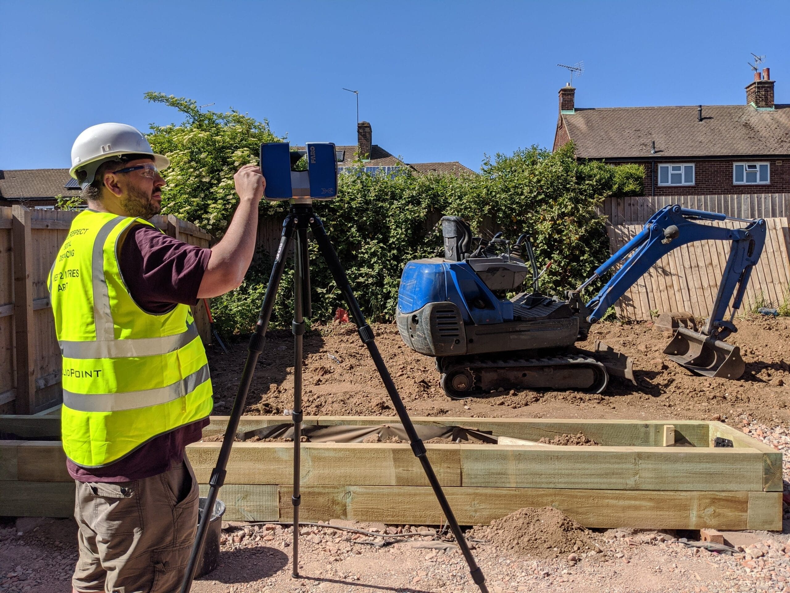
A topographical survey, sometimes called a land survey, provides an accurate representation of natural and man-made features within a specified area. These surveys are undertaken using precision equipment and the latest technology.
Topographical services have a variety of uses, including clearly showing land boundaries, flood risk modelling, building planning, utility mapping and for building alterations and designs.
At SolidPoint, we offer precise topographical surveys across Birmingham using cutting-edge technology. Our surveys provide detailed data on natural and man-made features, crucial for planning, boundary setting, flood risk assessments, and more.
What Is a Topographical Survey?
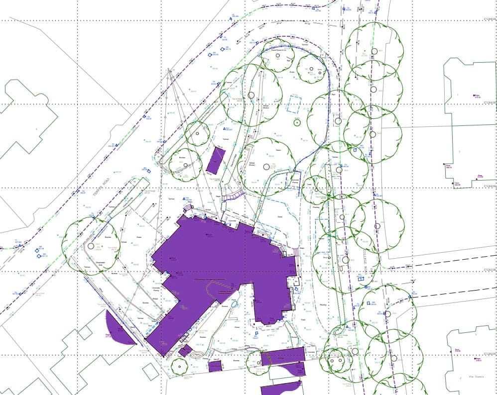
A topographical survey maps the current site boundaries, building footprints of existing and neighbouring structures, drainage, trees, ground surface types and levels of a site plus many more features that vary from site to site.
Other observations obtained reflectorless include ridge and eaves heights of the current and neighbouring buildings, overhead cables, tree heights, bridge soffits and other key structures.
How Much Does a Topographical Survey Cost?
Our pricing calculator provides an instant guide to the cost of professional topographical surveys across the UK. Simply select your land type, choose the appropriate size, and calculate travel costs to receive a tailored estimate.
Topographical Survey Prices
| Property Size | Price |
|---|
Estimate summary
Why SolidPoint?
Our Topographical services comprehensively identify all relevant visible site features, in accordance with the RICS publication titled “Specification for Surveys of Land, Buildings and Utility Services.” This ensures adherence to UK standards, providing you with peace of mind. Moreover, we can customise the specification to align with your specific requirements, guaranteeing that no essential details are overlooked.
To enhance the accuracy and efficiency of our land surveys, we employ state-of-the-art technology such as robotic equipment, laser scanners, and drones. With this advanced approach, we capture information in the most optimal manner, delivering exceptional value to your project.
Why Is an Accurate Survey Important?
If you’re looking to develop your land, then an accurate survey of the levels and features is essential.
Without reliable measured information, it can be easy for mistakes to occur, leading to wasted time on site for contractors, planning application delays, and potential limitations in your construction plans. Investing in an accurate and well-detailed Survey will prove to be a valuable investment, saving you significant time and costs while ensuring the success of your project.
Take a look at our case studies and see for yourself!
Topographical Land Services:
- Topographical / Land Survey – 2D or 3D presented in CAD and PDF formats.
- River Cross section data – presented in CAD and flood modeler formats.
- Property Boundary Surveys.
- Utility and drainage connectivity surveys (GPR & PAS128) These provide a topographical survey with underground services context – 2D or 3D presented in CAD and PDF formats.
Fast Turnaround:
We employ state-of-the-art technology that allows a quick turn around from the site work to data delivery.
Cost Saving:
Due to the increased levels of accuracy, there is often little need for correction or re-working. Saving you both time and money.
High Accuracy:
The 2D drawings, 3D Models or Building Information Models (BIM) we supply, can be completed to the highest level of accuracy and detail.
Get Started with a Topographical Survey in Birmingham
Elevate your project with our precise topographical survey services. Contact SolidPoint today to schedule a consultation and find out how our surveys can deliver the detailed terrain data you need for accurate and effective project planning.
Some Areas We Cover
Birmingham
Bristol
Burton-on-Trent
Chesterfield
Derby
Hull
Leeds
Leicester
London
Manchester
Nottingham
Peterborough
Sheffield
Stockport
York
Stay updated with us:
How Can SolidPoint Help Your Project?
At SolidPoint, we are passionate about providing accurate and efficiently collected data for our clients and have worked on numerous projects across the UK. If you are looking to commission a survey in your next project, please don’t hesitate to Get in touch with a member of our friendly team to discuss your requirements and get a free quote.
Alternatively, you can call us on 01332 898350 or email us at projects@solidpoint.co.uk for more information on our services. We look forward to hearing from you!
Give us a call on
Request a Free Quote




Trusted Suppliers for:
