Everything You Need to Know About 3D Drone Surveys
Find everything you need to know about 3D drone surveys, condensed into one short page
Written by: J.Jackson | Published 20th October 2026
Drone surveys have changed the way buildings, land and infrastructure can be inspected and measured. By capturing detailed information from above, they provide project teams with a clear view of areas that may be difficult, expensive or unsafe to access using traditional methods.
They can be used to record roof conditions, survey façades, map large areas of land, create 3D models and support construction, refurbishment, planning and maintenance projects.
In This Page
Download this page as a pdf
What Is a Drone Survey?

Aerial Drone Surveys
If you need a large area of land surveying rapidly, or struggle to access it. Then an Aerial Drone Survey is your best option. Provided as a 3D model or simple images and video.
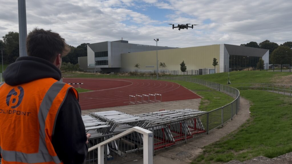
A drone survey uses an unmanned aircraft fitted with cameras, sensors or LiDAR equipment to collect information from above.
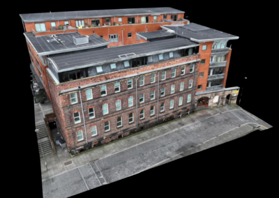
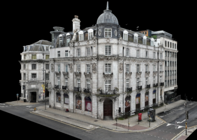
During the survey, the drone follows a planned flight path while capturing overlapping photographs or other forms of spatial data. This information can then be processed to produce accurate drawings, aerial imagery, point clouds, measurements, inspection photographs or detailed 3D models.
Unlike general aerial photography, a professional drone survey is designed around a specific project requirement. The aim may be to measure a site, inspect the condition of a building, record construction progress or provide a digital model for use by architects, engineers and contractors.
Why Drone Surveys Matter
Many projects depend on understanding parts of a building or site that cannot be easily viewed from ground level.
Roofs, towers, façades, industrial structures and large areas of land can be difficult to inspect safely. Without reliable information, project teams may have to rely on old drawings, limited photographs or assumptions about the condition and layout of the site.
A drone survey provides a detailed overview that can help designers, contractors, building owners and facilities managers make better-informed decisions.
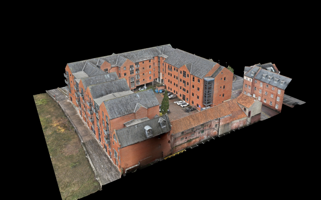
High-resolution aerial images can reveal damaged roof coverings, blocked gutters, defective cladding, areas of water ingress and other visible issues. Survey data can also be used to produce measured outputs, allowing teams to examine dimensions, levels and site features without repeatedly returning to the site.
This creates a reliable record of existing conditions and gives the wider project team information that can be reviewed throughout the design, construction or maintenance process.
When Do You Need a Drone Survey?
You may need a drone survey when important parts of a building or site are difficult to access, when a large area needs to be recorded efficiently or when detailed aerial information would improve project planning.
They are commonly commissioned during the early stages of a project so that existing conditions can be understood before design work begins. They can also be used during construction to monitor progress and after completion to create an accurate record of the finished works.
A drone survey may be appropriate when:
-
- A roof cannot be safely inspected from ground level
- Scaffolding or access equipment would be expensive
- A large site needs to be mapped
- A building has complex elevations or roof structures
- The condition of a potentially unsafe structure needs to be assessed
- A project requires current aerial imagery
- A 3D model or point cloud is needed
- Progress must be recorded across several site visits
- Traditional surveying methods cannot provide a complete view
- A permanent visual record is required for maintenance or asset management


Drone image → Drone model
Key Benefits
Access to Difficult Areas
Some parts of a building may be difficult to reach even with scaffolding or mechanical access equipment.
Drone-mounted cameras can capture high-resolution photographs of roof slopes, parapets, gutters, cladding panels, plant areas and complex elevations that may otherwise be hidden from view.
This helps create a more complete record of the property.
Detailed Visual Records
Drone surveys provide clear, current imagery of the site or structure at the time of the survey.
These images can be used to identify visible defects, brief contractors, support maintenance planning and demonstrate how conditions have changed between visits.
They also provide a useful record if questions arise later in the project.
Less Disruption
Drone surveys can often be completed with limited interruption to the normal use of a site.
There may be less need to close internal areas, install temporary access equipment or move people through occupied buildings.
This can make drone surveys useful for schools, offices, industrial sites, residential buildings and other operational environments, subject to the necessary flight permissions and safety controls.
Repeatable Progress Monitoring
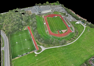
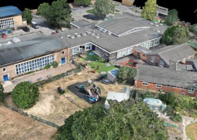
Drone flights can be repeated at agreed intervals to record how a project is progressing.
Using similar flight routes and camera positions allows teams to compare different stages of construction, document completed work and maintain a visual project record.
How Much Does a Drone Survey Cost?
Our pricing calculator provides an instant guide to the cost of professional drone surveys across the UK. Simply select your property type, choose the flight distance, and calculate travel costs to receive a tailored estimate.
How They Can Reduce Costs
Drone surveys can reduce project costs by limiting the need for scaffolding, mobile elevating work platforms, cherry pickers and other specialist access arrangements.
Drone surveys may also reduce costs by:
-
- Identifying defects before they become more serious
- Reducing repeat visits to verify existing conditions
- Helping teams plan repairs more accurately
- Providing clearer information for tendering
-
- Reducing assumptions during design
- Improving coordination between consultants
- Recording progress without interrupting construction activities
- Providing reusable data for future project stages
The greatest savings often come from reducing uncertainty. When designers and contractors have better information at the beginning of a project, they are less likely to encounter unexpected conditions that lead to delays, redesigns and additional site work.
What Will You Receive?
Every project is different, so deliverables vary. Below, you can find what’s included as a standard in every SolidPoint drone survey.
No two scopes are the same, so neither are our processes – discuss your project’s needs with our surveyors, who will put together a package that works best for you.
You will receive:
- The full gallery of raw images taken by the drone
- An interactive 3D model as an OBJ file
*If you require a file format that isn't listed as our standard, please reach out to the team who will make reasonable adjustments to fit your scope.
Which professionals may find a drone survey useful:
An OBJ model
A simple text-based file that tells a computer how to build a 3D shape using points and connections, so you can build the model yourself with the correct software.
Conclusion
Drone surveys offer a safe, efficient and highly visual way to understand buildings, land and infrastructure.
They can reduce the need for expensive access equipment, capture large or difficult areas quickly and provide detailed information for design, inspection, construction and maintenance. When properly planned, the same dataset can support several members of the project team and remain useful throughout the life of the project.
Stay updated with us:
How Can SolidPoint Help Your Project?
At SolidPoint, we are passionate about providing accurate and efficiently collected data for our clients and have worked on numerous projects across the UK. If you are looking to commission a survey in your next project, please don’t hesitate to Get in touch with a member of our friendly team to discuss your requirements and get a free quote.
Alternatively, you can call us on 01332 898350 or email us at projects@solidpoint.co.uk for more information on our services. We look forward to hearing from you!
Give us a call on
Request a Free Quote





Trusted Suppliers for: