
Aerial Drone Surveys
Embracing Advanced Drone Survey Technology
SolidPoint offers premier drone survey services, utilising advanced technology to provide comprehensive aerial views that support both development and conservation projects throughout the country, including projects in London and Manchester.
What Is an Aerial Drone Survey?
Aerial drone surveys employ cutting-edge drone technology to capture high-resolution images and data from above, offering a unique vantage point that is not possible with traditional surveying methods. This aerial perspective is essential for planners, developers, and conservationists in Derby, the Midlands and across the UK who need to assess, plan, and manage projects with a comprehensive overview of the landscape.

How Much Does a Drone Survey Cost?
Our pricing calculator provides an instant guide to the cost of professional drone surveys across the UK. Simply select your property type, choose the flight distance, and calculate travel costs to receive a tailored estimate.
Benefits of Aerial Drone Surveys for Inspections
In today’s construction and real estate landscape, having granular, precise data has never been more essential. For effective refurbishments, having comprehensive data is paramount.
Whether you’re a designer, contractor, or facility manager, making informed decisions is crucial. Aerial drone surveys bring you unparalleled perspectives, transforming challenges into solutions.
From pinpointing leaks causing property damage to understanding the intricacies of an unreachable roof, aerial drone survey inspections are the optimal way to gather necessary data.
Drone surveys represent a modern, efficient, and safer alternative to traditional surveying methods, bringing a new level of precision and accessibility to various fields.
Inspection data highlights include:
- Roof damage assessments
- Inspections of hard-to-reach or inaccessible areas
- Surveys of potentially hazardous buildings
- Land contour and elevation assessments
- Building facade condition surveys
Why Choose SolidPoint?
When you choose SolidPoint, you're not just opting for a service—you're investing in peace of mind. Your project benefits from CAA (Civil Aviation Authority) certified Drone Pilots boasting over 500 successful flights. We continuously invest in the newest technologies, guaranteeing the most accurate data for your project and crafting workflows tailored exclusively for you.
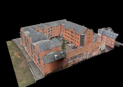
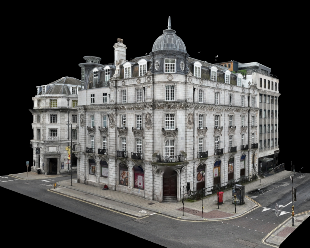
Take a look at our case studies and see for yourself!



Get Started with a 3D Drone Survey Today
Elevate your project with our advanced aerial drone technology. Contact SolidPoint today to schedule a consultation and learn how our drone surveys can provide you with the comprehensive data and imaging necessary for successful project management.
Explore our surveys from Derby across the Midlands and the UK, including geomatic structural surveys, measured building surveys, topographical surveys and PAS 128 utility surveys. Request a proposal.
Areas We Cover:
Derby
Nottingham
Leicester
Birmingham
Sheffield
Manchester
Leeds
London
Frequently asked questions
How much does a drone survey cost?
The cost depends on the property type, flight distance and travel required. Our drone survey calculator gives an initial guide using those details. Send us the site location and explain what you need to inspect or record so we can discuss the survey scope and provide a quotation for your project.
What can a drone survey be used for?
Drone surveys capture aerial images and data for inspections and site assessment. Our published applications include roof damage, building facades, hard-to-reach areas, potentially hazardous buildings and land contours. The aerial viewpoint helps project teams assess existing conditions and plan work where a ground-level view does not provide enough information.
What information will I get from a drone survey?
A drone survey provides aerial imagery and site data for the inspection or assessment you commission. The required output depends on whether you need to examine a roof, building facade or wider landscape. Tell us what decisions the information must support so we can agree the survey scope and deliverables.
Can a drone survey be combined with laser scanning?
Yes. We can use drone capture for out-of-reach areas alongside laser scanning and 360 tours to build a more comprehensive condition record. The methods provide different views of the same asset. We agree the combination around your property and the information your project team needs from the survey.
Do you carry out drone surveys in Derby and across the UK?
Yes. SolidPoint provides aerial drone surveys in Derby, throughout the Midlands and across the UK, including projects in London and Manchester. Our service supports development, inspection and conservation work. Send us the site location and the areas you need assessed so we can discuss the scope of your project.
Request a proposal
Tell us about your survey and we’ll help you take the next step.




Trusted Suppliers for:










Request a proposal
Use the full proposal form to add survey details and upload plans. Privacy policy