
Point Cloud Surveys
Point Cloud Surveys: Accurate, Proven 3D Data Capture
Laser scanning has been the industry standard for capturing existing buildings and sites for years, and it's still the most accurate and complete way to do it. A point cloud survey records every visible detail in 3D, giving you a reliable record to design, plan and build from.
What is a Point Cloud Survey?
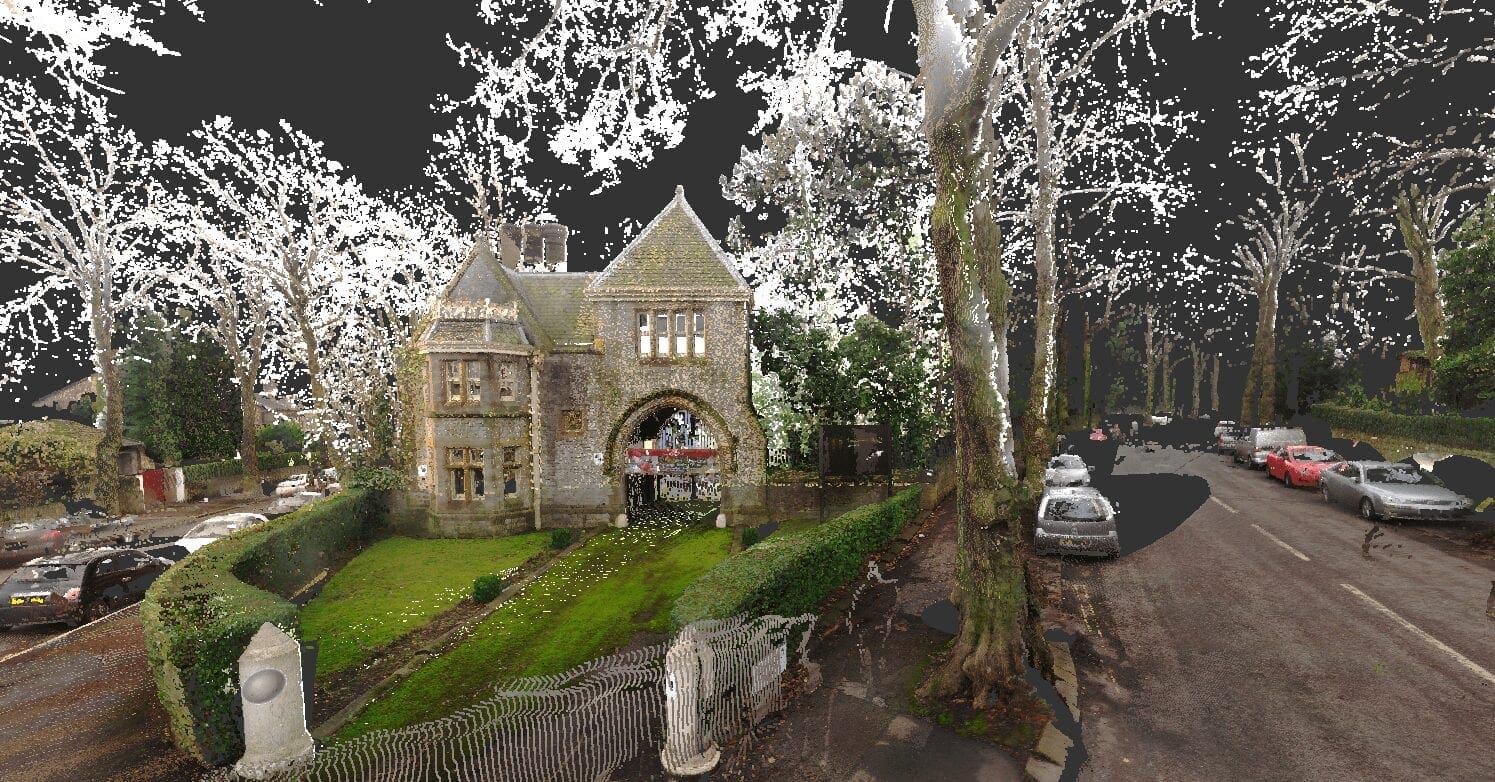
A point cloud survey uses a laser scanner to capture millions of measured points from a building or site, forming an accurate 3D record of what's there. You receive the point cloud in RCP and E57 formats, ready to work from in Revit or AutoCAD, and we can produce drawings or models from it if you need them. Architects, engineers, contractors and heritage teams use this data to design, coordinate and record existing buildings.
How Much Does a Point Cloud Survey Cost?
The cost of a point cloud survey mainly depends on how long we need on site and what you need at the end. For many projects, the simplest way to price it is by time on site.
Both packages below include scan registration, with the point cloud delivered in RCP (Autodesk ReCap) and E57 formats. These figures come from our laser scanner and operator hire service, where a qualified surveyor attends site with the scanner on your behalf.
£528 + VAT*
Roughly 30 to 35 major scans, plus the intermediate scans needed for accurate alignment. That's typically enough for a large 5 to 6 bedroom property, or two small neighbouring 3-bedroom properties.
£967 + VAT*
Roughly 60 to 70 major scans, plus the intermediate scans. That's typically enough for a small commercial office building, a series of street elevations for rights to light, or an open-plan library or warehouse.
*Travel is charged on top of these prices.
What affects the price
- Site size and complexity: more rooms, floors or elevations mean more scan positions and more time on site.
- Level of detail: tighter scan spacing for fine detail, such as heritage features or plant rooms, takes longer.
- Access: restricted access, working hours, occupied buildings, or sites that need a second operator for health and safety. An additional operator is £155 + VAT per day.
- Colour: full-colour scanning costs nothing extra, but it adds about 3.5 minutes per scan position, so fewer scans fit into the time.
- Positioning: tying the scan to permanent survey control (£498 + VAT per day) or to a local or global coordinate system with GPS (£249 + VAT per job).
When a fixed quote makes more sense
Half or full day hire works well when you know what you need captured and plan to work with the data yourself. For larger or multi-visit sites, projects that need survey control, or jobs where you want finished drawings or a BIM-ready Revit model, we'll give you a fixed quote for the whole job instead.
Request a proposal: tell us about your site and what you need from the data. Call 01332 898350, email projects@solidpoint.co.uk, or use the pricing calculator below for an instant estimate.
Why Choose SolidPoint for a Point Cloud Survey?
Our commitment to technology and precision places us at the forefront of the Surveying industry to deliver consistently reliable and accurate point clouds. With state-of-the-art equipment, a team of skilled professionals, and a passion for excellence, we ensure your project's data is accurate, comprehensive, and actionable. We capture point clouds UK-wide, from a food factory in Hull to a hospital in Chesterfield, and we cover Sheffield, Leeds and the rest of Yorkshire too.
We Provide:
- Local Expertise, UK-Wide Coverage: We know the buildings and planning requirements of the Midlands inside out, and we carry out surveys right across the UK, tailored to local planning and development requirements wherever your project is.
- Precision and Accuracy: Utilise precise and comprehensive data to streamline project planning, design, and execution.
- Time-Saving: Our technology rapidly collects data, reducing time on site and speeding up your project timeline.
- Versatile Applications: From historical preservation efforts around Pickford House to aiding renovations plans for Rolls Royce, our 3D models provide essential information for a variety of applications.
Take a look at our case studies and see for yourself!

Our Process
Consultation
Discuss your project’s scope and specific needs with our team. No two scopes are the same, so neither are our processes.
Site Visit
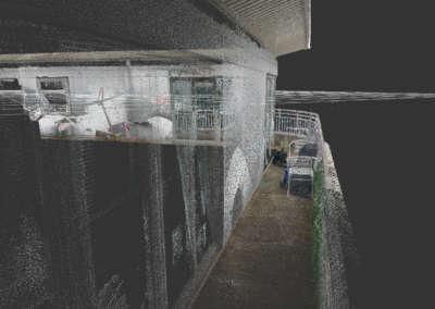
Our technicians visit the site to perform a high-definition survey.
Data Processing
We process the captured data into a usable model.
Every scan is Quality Assured both during and after the registration phase to ensure you receive the best possible data set.
Delivery
You receive a detailed data set, along with comprehensive support for understanding and utilising the data.
Here is what you'll receive as a standard from every SolidPoint Point Cloud Survey:
You will receive:
A ZIP file containing:
- A RCP file
- A support folder for the RCP file (these need to be together)
- An E57 file
- FGSX file
*If you require a file format that isn't listed as our standard, please reach out to the team who will make reasonable adjustments to fit your scope.
Which professionals may find a point cloud survey useful:
- Architects
- Structural Engineers
- Surveyors
- BIM Specialists
- Heritage Consultants
File Types & Definitions
RCP (Recap File)
This is the Recap project. It is usually Unified / Decimated to 10mm.
FGSX
This is a way to view the scans in “real view” (go into the scan)
Benefits of Our Point Cloud Survey Services
- Precision: Capture minute details that might be overlooked by traditional surveying methods.
- Time-Efficiency: Reduce site visits and fast-track your project timeline.
- Cost-Effective: Minimise costly errors and reworks.
- Safety: Survey hazardous or inaccessible areas without putting staff at risk.
- High Accuracy: Capture precise measurements, ensuring detailed and accurate representations of real-world structures or objects.
- Comprehensive Data: Collect millions of data points to create a holistic representation of the surveyed area, capturing every nuance and detail.
- Flexibility: Suitable for a wide range of applications, from architectural modelling and heritage conservation to industrial design and topography.
- Integrated Analysis: Compatibility with various software allows for in-depth analysis, manipulation, and visualisation of data.
- Streamlined Workflow: Digital data can be easily shared, stored, and integrated into CAD, BIM, or other visualisation tools.
- Consistency: Offers a standardised method of data collection, ensuring consistent results regardless of the environment or conditions.
- Detailed Documentation: Provides a thorough digital record of sites or structures, valuable for historical preservation, future planning, or legal documentation.
- Interactive Visualisation: Allows stakeholders, architects, or planners to engage with a virtual environment, aiding in decision-making and design processes.
- Reduces Rework: By obtaining detailed and accurate measurements the first time, rework due to errors is significantly minimised.
- Environmentally Friendly: Reduces the carbon footprint by limiting the need for multiple site visits and transportation.
- Archival: Maintains a digital twin or replica for future reference, useful for monitoring changes or degradation over time.
- Seamless Integration: Point cloud data can be easily integrated with other datasets or surveying methods for a comprehensive analysis.
Applications of Point Cloud Surveys
From heritage conservation to urban planning and infrastructure development, Point Cloud Surveys are reshaping the way we understand and interact with our environment. Some of its pivotal applications include:
- Architectural modelling and BIM: Convert point cloud data into detailed architectural models.
- Topographical Mapping: Get detailed terrains and landscapes in high resolution.
- Historical Site Documentation: Preserve intricate details of heritage sites.
- Infrastructure Analysis: Assess the condition and needs of infrastructure, from bridges to tunnels.
- Forensic Investigations: Capture crime scenes in intricate detail for evidence or event reconstruction.
- Industrial & Manufacturing Planning: Optimise workflow and safety in factory and industrial settings.
- Environmental Studies: Monitor natural environment changes, such as erosion patterns or forest density.
- Urban Planning: Aid city planners in visualising current layouts and predicting growth patterns.
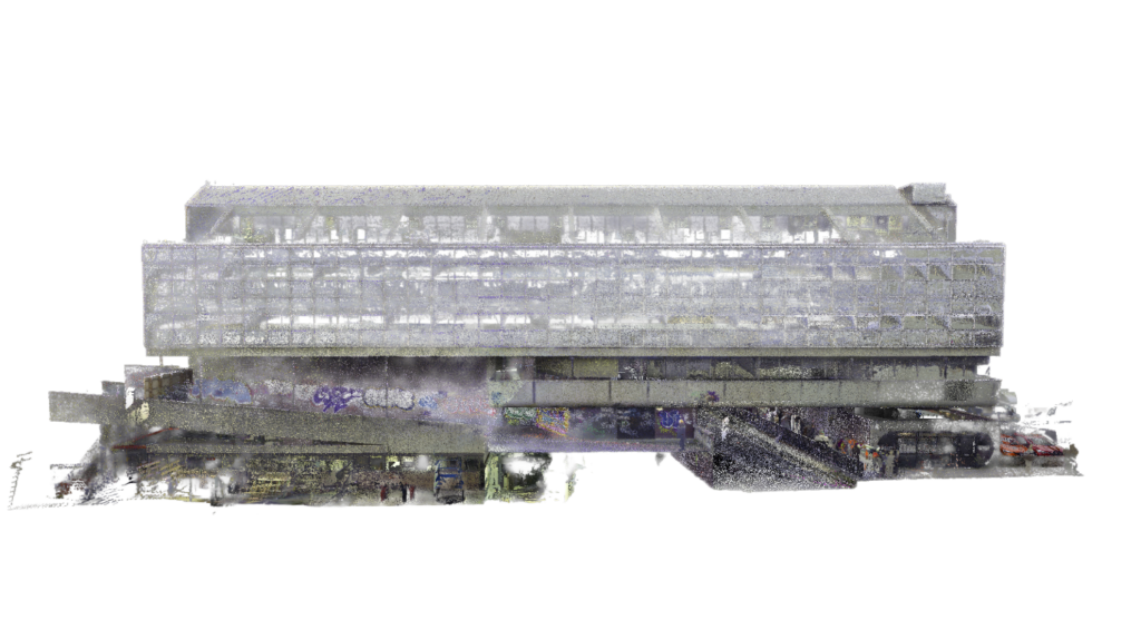
The RICS document using Point Cloud Surveys in their publicised standards which we always ensure we adhere to to meet your project needs.
Beyond these specific applications, the potential of point cloud surveys is vast. They can be utilised in a myriad of industries, from entertainment and gaming to academic research and cultural preservation. As technology progresses, the adaptability and versatility of point cloud surveys allow for almost limitless applications, each unlocking new avenues for understanding and interacting with our world.
Get started with a Point Cloud Survey Today
Ready to enhance your project with cutting-edge 3D survey technology? Contact SolidPoint today to schedule a consultation and discover how our point cloud surveys can bring precision and efficiency to your next project.
Frequently Asked Questions (FAQs)
What is LiDAR?
LiDAR (Light Detection and Ranging) works a bit like a bat, except it uses laser pulses instead of sound. The scanner sends out millions of tiny, invisible flashes of light a second and times how long each one takes to bounce back.
Since light always travels at the same speed, it can work out the exact distance to whatever the light hit. Do that across a whole scene and you end up with a very detailed 3D picture of the ground, buildings, or land features such as trees.
What is a point cloud?
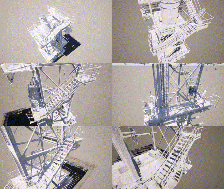
Think of a giant 3D connect-the-dots made from millions of laser measurements. When the scanner hits a room or an object, it records the position of every spot the light lands on. Zoom out, and all those dots together form a digital copy of the real thing, accurate down to the millimetre.
What is a laser scanning survey?
Picture a tripod that fires millions of invisible lasers out in every direction. When a laser hits a wall, a pipe, or a ceiling, it bounces back to the scanner, which works out how far away that point was from how long the light took to return.
Put all those measured points together and you have a point cloud: a complete 3D copy of the space on your computer, accurate to the millimetre.
What is a Faro scanner and how does it work?
A FARO scanner is a well-known brand of 3D laser scanner. It looks like a small box sitting on a camera tripod, and it's built to map a room or building in 3D.
Inside, it turns in a circle while a small mirror spins at high speed, sending out a laser beam and reading the light that comes back. FARO's Focus scanners use a method called phase-shift: rather than timing a single pulse, the beam's intensity ripples in a known wave pattern, and the scanner compares the outgoing and returning waves to work out the exact distance to each spot.
It records up to around a million points a second (more on the newer models). All those measured dots add up to a point cloud, which is an accurate 3D model of the room. At the end, a built-in camera takes photos so the dots can be coloured in, and the result looks like a real 3D photo on screen.
What are point clouds used for?
Point clouds are used to make accurate 3D versions of buildings, land, and objects. Because they capture a space to within a centimetre or less, surveyors and architects use them to build BIM models, track how a construction job is progressing, and keep records of historic sites.
Film and TV crews use them for "digital scouting": measuring a set, planning the lighting, and working out where to put the cameras before they turn up on location.
They're also used by self-driving cars to sense what's around them, and by game studios to build detailed environments.
How much does a point cloud survey cost?
Prices start from £528 + VAT for a half day (3 hours on site) or £967 + VAT for a full day (6 hours on site), including registration into an aligned point cloud. Travel is charged on top. Larger projects are priced with a fixed quote.
Is scan registration included in the price?
Yes. Both packages include registering the scans into a single aligned point cloud, supplied in RCP (Autodesk ReCap) and E57 formats.
How much can you scan in a day?
In 6 hours on site our operator can typically collect 60 to 70 major scans, plus the extra scans needed for alignment. That's usually enough for a small commercial office, a run of street elevations, or an open-plan warehouse. 3 hours covers roughly 30 to 35 major scans.
Does colour scanning cost extra?
No, full-colour scanning is free. It adds about 3.5 minutes to each scan position, though, so fewer scans can be collected in the same time.
Can the point cloud be tied to survey control or real-world coordinates?
Yes. We can position the data on permanent survey control stations (£498 + VAT), or to a local or global coordinate system using GPS (£249 + VAT). This is useful for larger sites, flood risk areas, or checking construction against as-built information.
Can you turn the point cloud into a Revit model?
Yes. We produce BIM-ready Revit models aligned to the point cloud, to the level of detail you need. Modelling is priced per project, so contact us for a quote.
Explore our surveys, including geomatic structural surveys, measured building surveys, topographical surveys and PAS 128 utility surveys. Request a proposal.
Areas We Cover:
Derby
Nottingham
Leicester
Birmingham
Sheffield
Manchester
Leeds
London
Request a proposal
Tell us about your survey and we’ll help you take the next step.




Trusted Suppliers for:














Request a proposal
Use the full proposal form to add survey details and upload plans. Privacy policy