
Survey Deliverables
We believe that transparency is key in everything we do, including letting you know exactly what you'll be getting from a SolidPoint survey.
Find your survey type/s and find out what you'll receive.
*If you require a file format that isn't listed as our standard, please reach out to the team who will make reasonable adjustments to fit your scope.
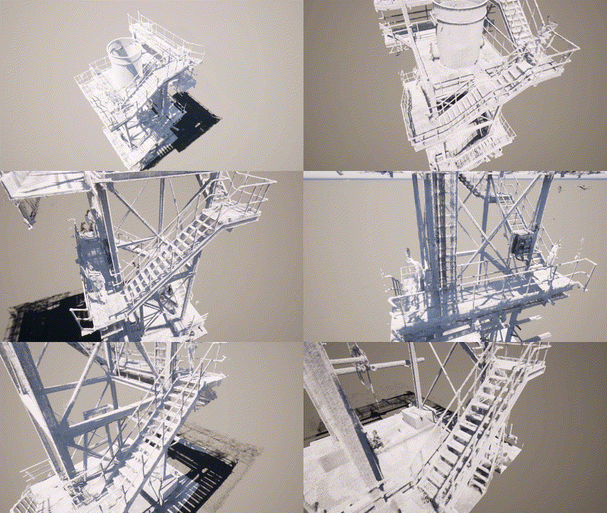
A Point Cloud Survey is a way of capturing a building or a site using laser scanning technology to fire millions of tiny lasers to measure every single surface, creating a massive digital cloud of data points.
These points will then create a 3D representation of the scope, accurately showing how the space exists in reality.
You will receive:
A ZIP file containing:
- A RCP file
- A support folder for the RCP file (these need to be together)
- FGSX file
*If you require a file format that isn't listed as our standard, please reach out to the team who will make reasonable adjustments to fit your scope.
Which professionals may find a point cloud survey useful:
- Architects
- Structural Engineers
- Surveyors
- BIM Specialists
- Heritage Consultants
RCP (Recap File)
This is the Recap project. It is usually Unified / Decimated to 10mm.
FGSX
This is a way to view the scans in “real view” (go into the scan)
Download the Point Cloud Deliverables pdf
Drone Survey
Aerial drone surveys employ cutting-edge drone technology to capture high-resolution images and data from above, offering a unique vantage point that is not possible with traditional surveying methods.
This aerial perspective is essential for planners, developers, and conservationists who need to assess, plan, and manage projects with a comprehensive overview of the landscape.
You will receive:
- The full gallery of raw images taken by the drone
- An interactive 3D model as an OBJ file
*If you require a file format that isn't listed as our standard, please reach out to the team who will make reasonable adjustments to fit your scope.
Which professionals may find a drone survey useful:
-
- Project Manager
- Site Manager
- Contracts Manager
- Quantity Surveyor
- Chartered Surveyor
- Land Surveyor
- Civil Engineer
- Asset Manager
- Facilities Manager
- Estates Manager
- Property Manager
- Development Manager
- Operations Manager
- Infrastructure Manager
- Maintenance Manager
- Planning Consultant
- Environmental Consultant
- Building Surveyor
- Roofing Manager
- Farm Manager
An OBJ model
A simple text-based file that tells a computer how to build a 3D shape using points and connections, so you can build the model yourself with the correct software.

Download the Drone Deliverables pdf
Measured Building Survey
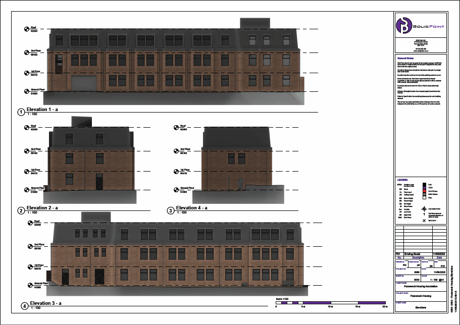
A Measured Building Survey is a precise and detailed recording of a buildings size, shape and layout.
This information is then turned into an accurate BIM model.
You will receive:
- A RCP file with the point cloud data
- A RVT file with the Revit model
- A PDF and DWG file with the sheets
The sheets we send you often contain:
- A Cover sheet
- Site Plan
- Floor Plans
- Elevations
- Sections
- Roof Plan
*If you require a file format that isn't listed as our standard, please reach out to the team who will make reasonable adjustments to fit your scope.
Which professionals may find a measured building survey useful:
- Architects
- Structural Engineers
- Site Managers/Contractors
- Planning Consultants
- Interior Designers
RCP (Recap file)
This is the Recap project. It is usually Unified / Decimated to 10mm.
RVT (Revit file)
A Building Information Model file that contains 3D building data and information of the project's scope.
PDF (Portable Document Format)
A file used to easily view and share drawings.
DWG (AutoCAD drawing file)
A widely used CAD file for AutoCAD used for 2D and 3D drawings.
IFC (Industry Foundation Classes)
An open BIM file format used to share models between different software applications.
Download the Measured Building Deliverables pdf
Topographical Survey
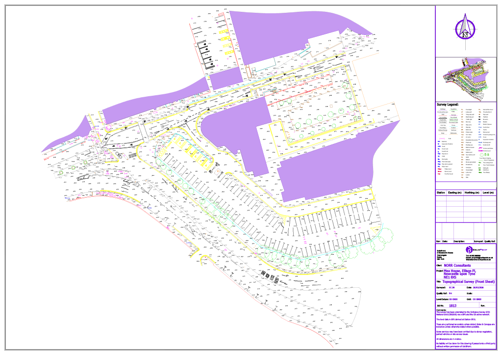
A topographical survey is a detailed measured survey of a site, capturing all visible features and levels. This includes buildings, kerbs, boundaries, trees, services, and ground levels.
It provides an accurate base drawing for design, planning, and construction.
You will receive:
PDF Drawing (Topo Sheet)
- Clear, scaled drawing of all surveyed features
- Includes levels, annotations, and key site information
2D CAD File (DWG)
- Plan-based drawing with all features and linework
- Layered and ready for design use
3D CAD File (DWG)
- Includes level data and 3D elements (where applicable)
- Suitable for modelling and more advanced design work
Revit Model (RVT) – Optional Extra
- Exported topographical survey in BIM format
- Provided only if requested, at additional cost
*If you require a file format that isn't listed as our standard, please reach out to the team who will make reasonable adjustments to fit your scope.
How a professional may use each deliverable:
PDF (Topo Sheet)
- Planning consultants may use this for reports and submissions
- Project managers may use this for a quick reference on site
2D DWG File
- Architects may use this as base drawings for design
- Engineers may use this for technical layouts and coordination
- CAD technicians may use this for further drafting work
3D DWG File
- Architects may use this as 3D context for design development
- Engineers may use for levels, gradients, and modelling
- BIM teams may integrate this into wider models
Revit Model (RVT)
- Architects may use this to aid BIM workflows and building design
- Engineers may use this for coordinated models and clash detection
- BIM coordinators may use this for project-wide model integration
PDF (Portable Document Format)
A non-editable drawing used for viewing and printing.
DWG (Drawing File – AutoCAD format)
An industry-standard CAD file used for both 2D drawings and 3D data.
RVT (Revit File)
A BIM model used for coordinated 3D design in Autodesk Revit.
Download the Topographical Deliverables pdf
Structural Survey
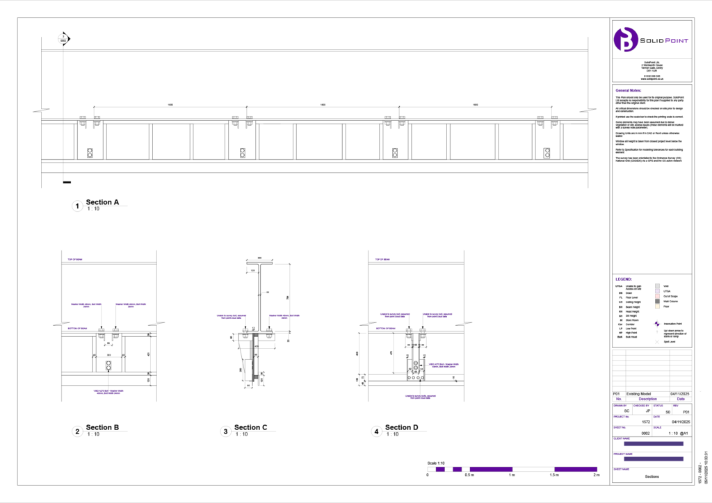
A Structural Survey precisely captures the dimensions, configuration, and exact location of structural elements within a building. This comprehensive service details the primary structural frame, as well as floor, ceiling, and wall structures.
Utilising precision tools such as callipers and advanced measuring equipment, our surveyors gather highly accurate site data. This information is then meticulously translated into detailed technical drawings.
You will receive:
As standard, final deliverables are provided in CAD (DWG) format alongside annotated PDF copies for easy viewing.
These sheets often contain:
- Cross Sections with annotations
- Connection Details With annotations
- Structural Grid with structure and annotations
- Images
Additionally, we offer the flexibility to deliver structural surveys as fully authored BIM/Revit models to suit your specific project requirements.
*If you require a file format that isn't listed as our standard, please reach out to the team who will make reasonable adjustments to fit your scope.
Which professionals may find each deliverable useful:
- Architects – DWG, PDF
- MEP engineers – DWG, PDF
- Structural Engineers – DWG, PDF, PNG/JPEG
- Site Manager/ Contractors – PDF
PDF (Portable Document Format)
A file used to easily view documents and drawings
DWG
A CAD (Computer Aided Design) drawing that you can open in most CAD software like AutoCAD and BricsCAD to view 2D and 3D Drawings.
PNG/JPEG
An Image file to show the current condition on site
Download the Structural Deliverables pdf
Boundary Survey
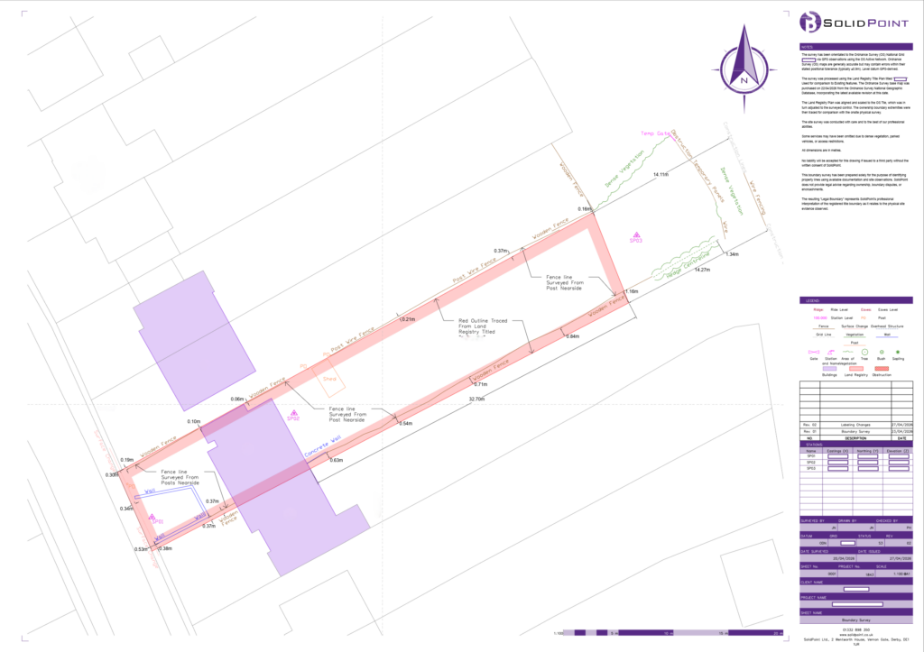
A boundary survey compares HM Land Registry title information against a measured site survey to identify the indicative position of legal boundaries. It highlights any visible discrepancies between mapped ownership and physical features on site.
Note: This is not a legally fixed boundary unless determined through legal process.
You will receive:
PDF Drawing (CAD Sheet)
Scaled drawing showing:
- Land Registry title boundary (scaled to OS mapping)
- Surveyed site features (fences, walls, etc.)
- Any indicative discrepancies highlighted
DWG File (CAD File)
- Full editable survey drawing
- Includes site survey data
ZIP Folder
- Contains all files (PDF + DWG)
- Includes the Title Plan integrated into the CAD file for reference
*If you require a file format that isn't listed as our standard, please reach out to the team who will make reasonable adjustments to fit your scope.
How a professional may use each deliverable:
PDF Drawing
- Architects and Planners may use your survey as a quick reference for design and submissions
- Solicitors may use the drawing supporting visual evidence
DWG File
- Boundary surveyors and Consultants may use this file to carry out a detailed analysis
- Architects and Engineers may integrate this file into design drawings
- CAD technicians may use it for further technical work
PDF (Portable Document Format)
A non-editable drawing used for viewing, sharing, and printing.
DWG (Drawing File – AutoCAD format)
An editable CAD file containing all survey data, layers, and geometry.
ZIP Folder
A compressed file containing all deliverables, ensuring nothing is lost and files remain organised.
Download the Boundary Deliverables pdf
PAS128 Utility Survey
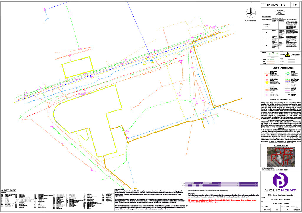
A Utility Survey is a specialised investigation carried out to identify and map the location of underground utilities such as water, gas, electricity, telecommunications, and drainage systems.
This process helps to prevent accidental service strikes during construction or excavation work and ensures the safety and efficiency of any project.
Utility Surveys help save time by aiding designers in showing them where services are for possible rerouting solutions or installation of new services in existing manholes and routes.
You will receive:
- Utility Mapping drawings of your survey, including 2D Drawing with Depths and services plotted and colour coded. You will receive this as a DWG and a PDF
- A comprehensive Survey Report PDF summarising the survey methodology and findings.
- Desktop Survey PDF of all the utility providers in the area, necessary for a PAS128 survey.
- A full gallery of images taken during the survey to provide visual evidence of utility locations and conditions of site. These will be in JPEG and PNG formats
- Risk Assessment and Method Statement PDF outlining safety procedures and survey methods necessary for a PAS128 Survey.
- Manhole Cards PDF showing details of all the Manholes and Inspection chambers that have been investigated.
*If you require a file format that isn't listed as our standard, please reach out to the team who will make reasonable adjustments to fit your scope.
How a professional may use each deliverable:
Utility Mapping Drawings
Used by architects, engineers, and site managers for design and construction planning. This is for planning where excavation will take place and with what tools to avoid service strikes. Also aids in planning on rerouting services or installing services into preexisting runs.
Survey Report
Shared with project managers, clients, and regulatory bodies for compliance and review. This is to get an overview of the site so that it can be used for planning or addressing urgent matters.
Photographic Records
Referenced by site managers and health & safety officers for site verification. Also used by designers and maintenance to determine the health and usability of service/cover
Risk Assessment and Method Statement
Essential for health & safety officers and contractors to ensure safe working practices. Used by Site Managers and some times site contact to ensure safety is adhered to.
PDF (Portable Document Format)
- Standard for sharing reports and drawings; viewable on any device.
- Likely to be used by Project Managers and Regulatory Bodies
DWG (AutoCAD Drawing)
- Editable drawing files used for technical plans and mapping.
- Likely to be used by Architects, Engineers and Surveyors
DXF (Drawing Exchange Format)
- Compatible with various CAD programmes for design integration.
- Likely used by Architects and Engineers
JPEG/PNG (Image Files)
- Used for photographic documentation of site surveys and evidence.
- Likely used by Site Managers and Health & Safety Officers
Download the Utility Deliverables pdf
CCTV Survey
A CCTV is an investigation carried out on required drainage using a large reel with a HD Camera attached to the end with light. The camera is operated through and external device, and records the track and drain as it goes down it.
This is a non-invasive method of carrying out inspections of Foul drains, Surface Water drains and Combined Drainage. Helps to identify issues, or possible connections without the need for excavation.
You will receive:
Survey Drawings -
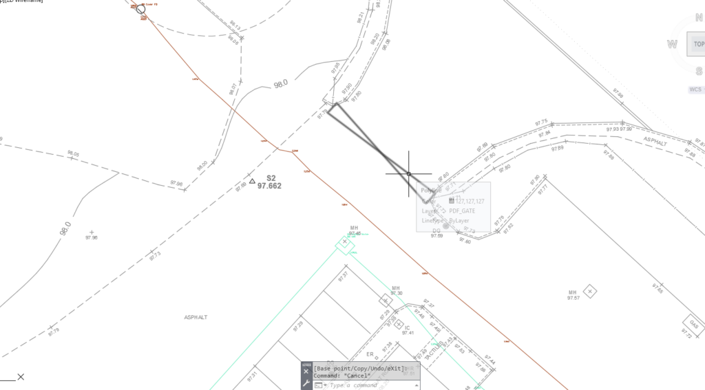
- DWG File with 2D Drawing with Depths and runs drawn and mapped
- PDF Sheets.
Survey Report -
- A comprehensive PDF document summarising the survey findings, highlighting any issues the surveyor has identified.
Photographic and Video Records -
- Images taken during the survey to provide visual evidence of utility locations and conditions of site, as well as the recording of the CCTV drain.
- Delivered to you in JPEG, PNG and MP4 Files
Manhole Cards -
- Shows details of all the Manholes and Inspection chambers that have been investigated.
- Delivered as a PDF
*If you require a file format that isn't listed as our standard, please reach out to the team who will make reasonable adjustments to fit your scope.
Which professionals may find each deliverable useful:
Drainage Mapping Drawings:
- Used by designers or utility owners to confirm which manhole is connected to which.
- More for indication purposes as well as for possible rerouting or joining up to.
Survey Report:
- Shared with project managers, clients, and regulatory bodies or service providers for compliance and review.
- This is to get an overview of the site so that it can be used for planning or addressing urgent matters, and having a highlight of any issues that are present in the drainage systems.
Photographic and Video Records:
- Referenced by designers, clients and utility owners to have a look over the system themselves.
- Also used by designers and maintenance to determine the health and usability of drain/cover
PDF (Portable Document Format)
Standard for sharing reports and drawings - viewable on any device.
DWG (AutoCAD Drawing File)
Editable drawing files used for technical plans and mapping.
DXF (Drawing Exchange Format)
Compatible with various CAD programmes for design integration.
JPEG / PNG (Image Files)
Used for photographic documentation of site surveys and evidence.
MP4
Standard Video File
Download the CCTV Deliverables pdf
Buried Obstruction Survey
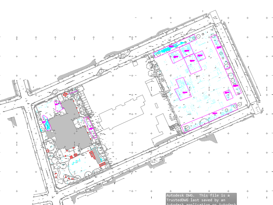
A Buried obstruction survey is a non-invasive method of locating underground anomalies and structures, such as old foundations, walls that have not been removed, crypts, basements, tunnels, large obstructions such as boulders or rock.
With this method, all anomalies are detected and plotted instead of ones going in a line or pattern to suggest possible services.
You will receive:
Obstruction Drawings
- DWG 2D Drawing with Depths and anomalies plotted and colour coded.
- PDF Sheets.
Survey Report
- A comprehensive PDF document summarising the survey findings.
Photographic Records
- Images taken during the survey to provide visual evidence of utility locations and conditions of site.
- Additionally, images of raw GPR Data as evidence.
- All images delivered as JPEG and/or PNG
*If you require a file format that isn't listed as our standard, please reach out to the team who will make reasonable adjustments to fit your scope.
Which professionals may find each deliverable useful:
Drawings:
Used by engineers, excavation planners, quantity surveyors for construction planning and to check if there are any artifacts or hidden anomalies that can cause issues for excavations.
Survey Report:
Shared with project managers, clients, engineers and quantity surveys for compliance and pricing.
Photographic Records:
Referenced by Designers, Quantity surveys, engineers and clients for confirming where areas of interest are.
PDF (Portable Document Format)
Standard for sharing reports and drawings - viewable on any device.
DWG (AutoCAD Drawing File)
Editable drawing files used for technical plans and mapping.
DXF (Drawing Exchange Format)
Compatible with various CAD programmes for design integration.
JPEG / PNG (Image Files)
Used for photographic documentation of site surveys and evidence.
Download the Buried Obstruction Deliverables pdf
Building Information Modelling (BIM)
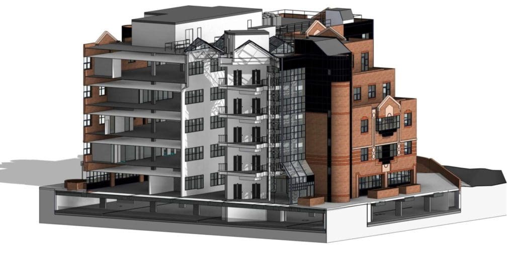
A Scan to BIM Survey is the process of capturing an existing property (land or building) using highly accurate laser scans, which are then used to produce an accurate architectural, structural, and/or MEP BIM.
You will receive:
A file package containing the point cloud data as well as a Revit Model:
- A RCP file with the point cloud data
- A RVT file with the Revit model
- A PDF and DWG file with the sheets
*If you require a file format that isn't listed as our standard, please reach out to the team who will make reasonable adjustments to fit your scope.
Which professionals may find BIM useful:
- Architects
- Structural Engineers
- Site Managers / Contractors
- Planning Consultants
- Interior Designers
- BIM Coordinators
RCP (Recap file)
This is the Recap project. It is usually Unified / Decimated to 10mm.
RVT (Revit file)
A Building Information Model file that contains 3D building data and information of the project's scope.
PDF (Portable Document Format)
A file used to easily view and share drawings.
DWG (AutoCAD drawing file)
A widely used CAD file for AutoCAD used for 2D and 3D drawings.
IFC (Industry Foundation Classes)
An open BIM file format used to share models between different software applications.
Download the BIM Deliverables pdf
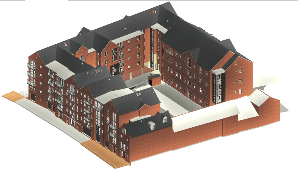
Revit Modelling
You will receive:
- A RVT file with the Revit model
- A PDF and DWG file with the sheets
The sheets we send you often contain:
- A Cover sheet
- Site Plan
- Floor Plans
- Elevations
- Sections
- Roof Plan
*If you require a file format that isn't listed as our standard, please reach out to the team who will make reasonable adjustments to fit your scope.
Which professionals may find a Revit model useful:
- Architects
- Structural Engineers
- Site Managers/Contractors
- Planning Consultants
- Interior Designers
RVT (Revit file)
A Building Information Model file that contains 3D building data and information of the project's scope.
PDF (Portable Document Format)
A file used to easily view and share drawings.
DWG (AutoCAD drawing file)
A widely used CAD file for AutoCAD used for 2D and 3D drawings.
Download the Revit Deliverables pdf
360 Tour
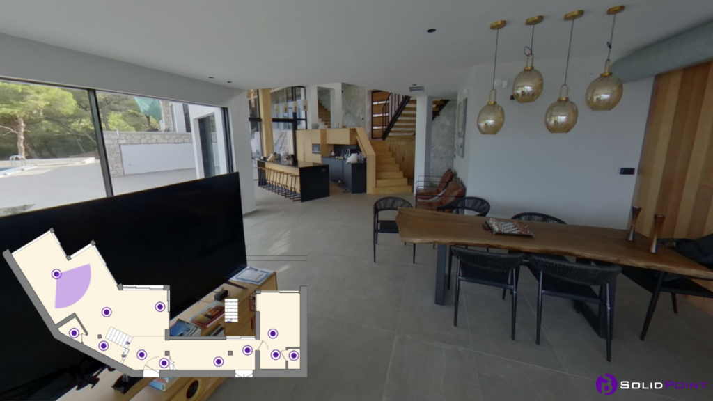
A 360 tour is a way of viewing a building online through a series of 360 images on a floorplan.
Just click on the hotspot on the floorplan for the image you want to look at and it’ll take you there, then you can look in any direction around the image.
You will receive:
- A link for the online tour
- The full gallery of raw 360 images
- If you require a hard copy of your tour, you will receive a file that you can view through software called “3DVista Tour Viewer
-
How a professional may use each deliverable:
- Every professional working on your project could benefit using a virtual tour link, as they allow seamless collaboration
- Architects or Surveyors may use the raw image files if they need to focus on a specific area of your property without being online
The raw 360 images will be in a jpg format, delivered to you in a zipped folder.
If you require a hard copy of your tour, this will be delivered to you in an .exe format.
Download the 360 Tour Deliverables pdf
