
Utility Clearance Surveys (PAS 128)
Before you drill a borehole, take core samples or break ground, you need to know what's underneath. A utility clearance survey checks the exact locations you plan to excavate or drill for buried services, so the work can go ahead safely. Our surveyors use Ground Penetrating Radar (GPR) and Electromagnetic Locators (EML), working in line with the British standard PAS 128, to find and mark services before anyone starts digging.
What is utility clearance and borehole clearance?
A full utility survey maps buried services across a whole site: where they run, how they connect and where they cross. Utility clearance is more focused. It checks specific points or small areas, such as borehole positions, trial pits, posts, footings or service trenches, and confirms whether they're clear of services, or where to move them if they're not.
Borehole clearance is the most common type. Ground investigation contractors and engineers need to know each borehole or core location is safe before they drill. Striking a cable or pipe can cause serious injury, damage essential services, and lead to costly delays and repairs.
How we carry out a clearance survey
Agree the locations.
You send us the proposed borehole or excavation positions, as a drawing, coordinates or marked-up plan. We can work to your specification, or put one together based on your project requirements.
Mark the positions on site.
Our surveyor sets out each borehole location accurately on the ground.
Scan for buried services.
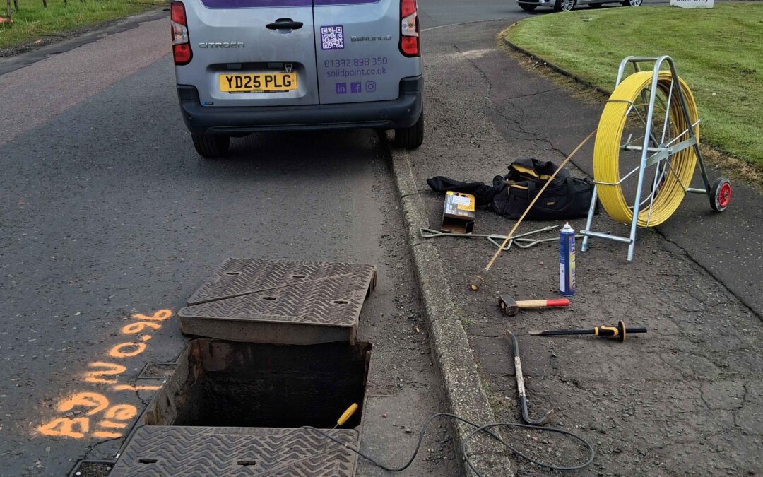
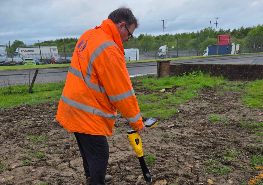
We search the area around each position with EML, which picks up metallic pipes and live cables, and GPR, which can detect non-metallic services such as plastic pipes. Where there are inspection covers and manholes nearby, we lift them to see what's running through.
Establish a clearance zone.
We confirm each location is clear, or mark the detected services and suggest a safe alternative position.
Report back.
You get the results in a format your drilling team can use on site.
What you get
- Each proposed location confirmed clear, or flagged with the services detected nearby
- Services detected around each location painted and marked out on the ground
- A marked-up drawing, report or CAD file showing borehole positions and detected services, or simply a mark-out on site, whichever you need
- Approximate depths for detected services, based on the GPR readings. These are indicative only, not guaranteed
- Photos and details of any manholes or inspection chambers we open
- Advice from the surveyor on safe positions if a location needs to move
When you need a clearance survey
- Before ground investigation boreholes, window samples or core samples
- Before trial pits, piling, posts, fencing or new foundations
- Before cutting service trenches or connections
- When a contractor or insurer needs proof that excavation locations were checked
- When existing utility records are incomplete, out of date or don't exist
If you're planning a larger development or redesign, a full PAS 128 utility survey of the whole site may suit you better. We're happy to advise which you need.
Case study: borehole clearance for Severn Trent Water, Birmingham
At Severn Trent Water in Birmingham, our client needed borehole locations cleared before drilling core samples. Our team marked each borehole position, scanned the area for hidden services using GPR and EML, and established a safe clearance zone for core sampling. The client could then go ahead with excavation without risking damage to essential services.
We carry out utility clearance surveys across the UK.
We also cover the North, the East and West Midlands, the South, Scotland, Wales and Northern Ireland.
Frequently asked questions
What's the difference between a utility survey and a utility clearance survey?
A utility survey maps buried services across a whole site. A clearance survey focuses on the specific spots you plan to drill or dig, such as borehole positions, and confirms they're clear of services before work starts.
What equipment do you use?
We use Electromagnetic Locators (EML) and Ground Penetrating Radar (GPR) together, and lift inspection covers and manholes where possible to see what's running through them.
Do you follow PAS 128?
Yes. Our qualified surveyors work in accordance with the British standard PAS 128, using proven techniques for accuracy. We can also work to a custom specification you provide.
What happens if a borehole location isn't clear?
We mark the services we've detected and find a safer alternative position on site, so your drilling team can carry on without a return visit.
How much does a utility clearance survey cost?
It depends on the number of locations, the site and travel. The pricing calculator on our PAS 128 utility survey page gives an instant guide, or send us your borehole plan and we'll send you a proposal.
Request a proposal: call 01332 898350, email projects@solidpoint.co.uk, or send us your borehole locations through our quote form.