Liberty Place, Liverpool
Measured Building Survey & 3D Drone Survey to aid a cladding remediation project
Written by J.Jackson | Published: 31st July 2026

Measured Building Survey
If you are planning a refurb, extension or just simply re-jigging the space you have, then you’ll need an accurate and reliable measured building survey to help you plan.

3D Drone Survey
If you need a large area of land surveying rapidly, or struggle to access it. Then an Aerial Drone Survey is your best option.
When undertaking a cladding remediation project, having accurate existing building data is essential. For this project in Liverpool, BBP required a detailed understanding of the building’s external facade, roof areas, window locations, and existing cladding conditions before remediation works could begin.
The primary challenge was accessibility. The upper sections of the building and roof areas could not be safely or efficiently reached using traditional survey methods alone. The client specifically needed detailed information about the cladding at the top of the building, areas that a standard scanner could not capture from ground level. They also required precise data to support fireproofing design and planning, including accurate window positioning and facade information.
To support the remediation project, SolidPoint delivered a combination of a drone survey and a measured building survey. This integrated approach provided BBP with a complete and accurate digital representation of the building’s external condition, enabling informed design decisions and improving overall project efficiency.
The survey work was completed in just one day on site, followed by five days of modelling and data processing.
Our Approach
For this cladding remediation project, we combined advanced surveying technologies to capture accurate information quickly, safely, and efficiently.
Drone Survey for High Level Access
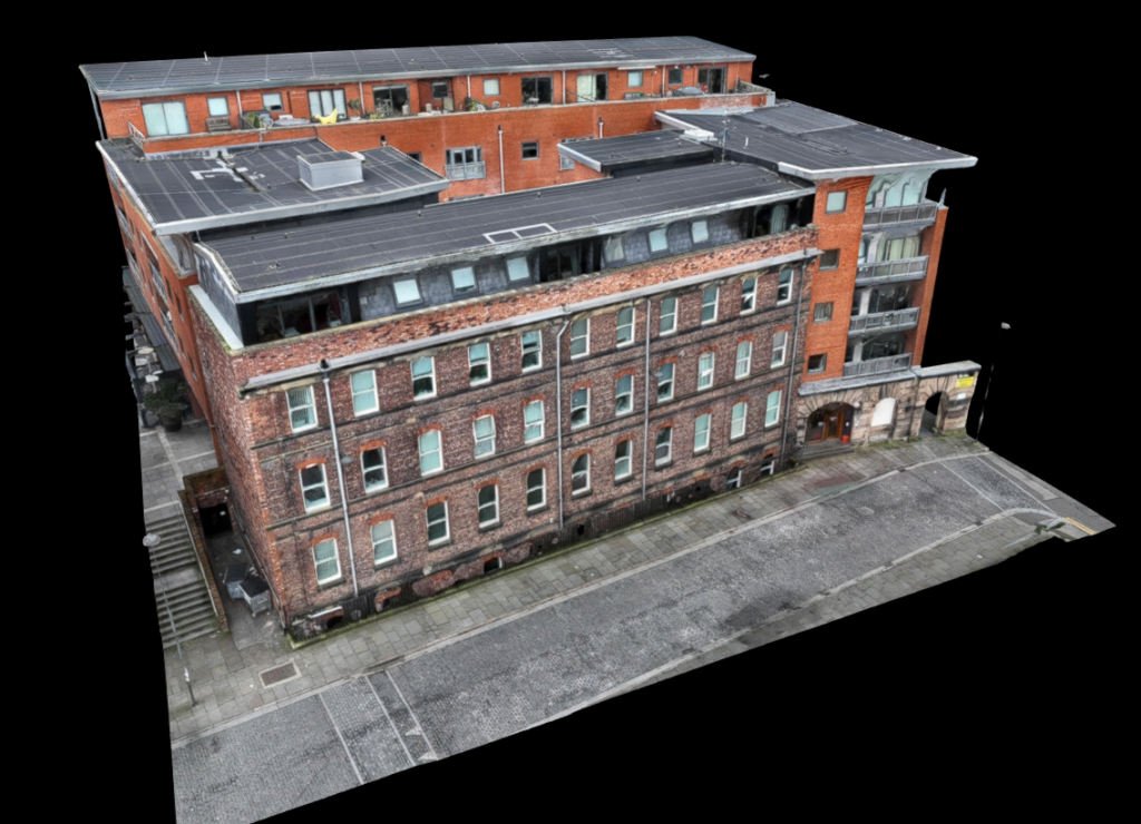
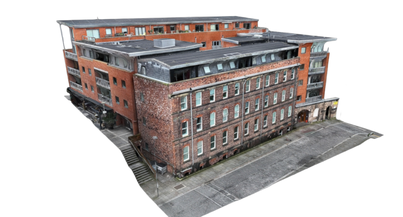
The first stage involved carrying out a drone survey of the building exterior and roof areas. Drone technology allowed our team to safely capture detailed imagery and data from hard to reach locations without the need for scaffolding, cherry pickers, or extensive access equipment.
This was particularly important for inspecting the upper cladding areas, which traditional scanning equipment could not fully reach. The drone survey also allowed the roof to be captured externally without accessing the internal areas of the building, reducing disruption and avoiding unnecessary costs.
The drone data provided a comprehensive overview of the building’s external walls and roof condition, giving the client clear visibility of potential issues with the existing cladding while also supporting the planning of future remediation and fireproofing works.
Point Cloud Survey for Accurate Existing Conditions
Alongside the drone survey, we carried out detailed laser scanning to produce point cloud data of the building in its current state.
Point cloud surveys provide highly accurate measurements and spatial information, creating a precise digital record of the structure. This enabled BBP to identify issues with the existing cladding system and ensured that all levels and dimensions were correctly controlled before remediation works began.
By combining drone data with terrestrial scanning, we created a complete dataset that accurately reflected the existing facade and external building geometry.
This level of accuracy is critical for cladding remediation projects, where even small measurement discrepancies can create delays, design clashes, or installation issues later in the programme.
Revit Modelling for Design and Coordination
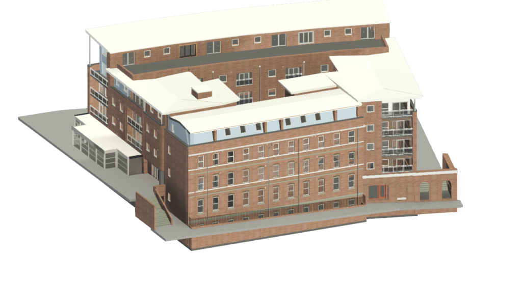
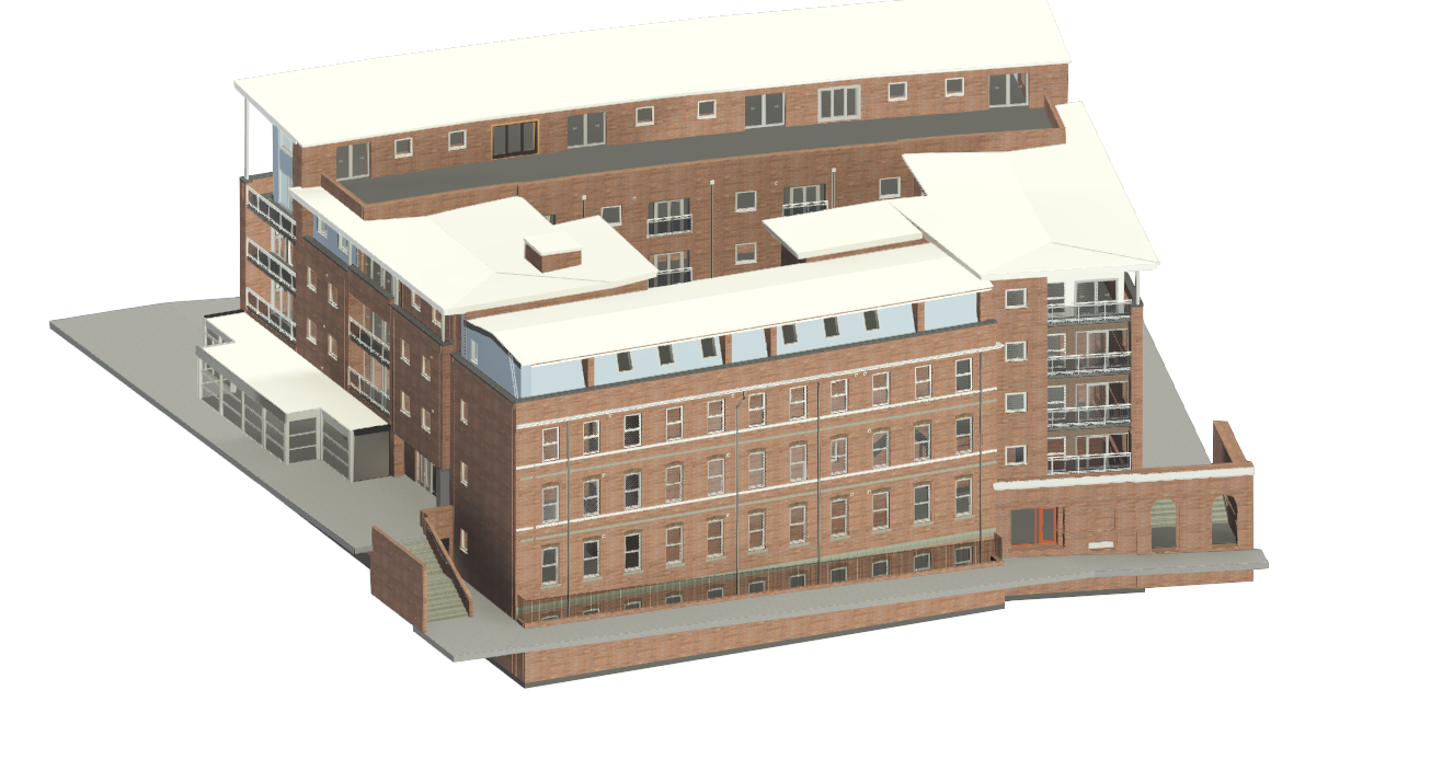
Once the survey data had been captured, our team processed the information into an accurate Revit model of the building facade and externals.
The Revit model provided BBP with reliable as built information to support the design and coordination of remediation works. Accurate window locations, facade geometry, and potential wall defects were all incorporated into the model.
Having a coordinated digital model meant the design team could work directly from verified site data rather than relying on outdated drawings or manual measurements, reducing the likelihood of inaccuracies and removing the need for designers to repeatedly revisit site to gather additional measurements.
The result was a dependable digital foundation for the fireproofing and cladding remediation works.
How Did Our Client Benefit From a SolidPoint Survey Package?
Safe and Cost Effective Access to Difficult Areas
One of the biggest advantages of using drone surveys was the ability to safely inspect hard to reach areas without expensive access equipment.
Traditional methods such as scaffolding or powered access platforms can significantly increase project costs and extend programme durations. By using drone technology, SolidPoint was able to rapidly capture detailed roof and upper facade data while minimising disruption to the site.
The drone survey also eliminated the need for separate roof inspection visits, improving efficiency and reducing overall project costs.
In addition, the drone imagery provided BBP with a clear visual overview of the building’s external condition, allowing potential cladding issues to be identified early in the project lifecycle.
Accurate Existing Building Information
Point cloud scanning and Revit modelling delivered an accurate representation of the building’s current condition.
For cladding remediation projects, reliable existing data is vital. Inaccurate measurements can lead to design clashes, fabrication issues, installation delays, and additional costs on site.
The point cloud survey ensured that all levels, dimensions, and facade details were precisely captured. This controlled dataset gave the project team confidence that the information being used for design and setting out was correct.
The resulting Revit model provided an accurate digital environment for the designers to work from, including precise window locations and facade details needed for fireproofing planning.
This improved coordination across the project team and reduced the need for repeated manual site measurements.
Faster Project Delivery and Improved Efficiency
By combining drone surveys, point cloud scanning, and Revit modelling into one coordinated workflow, SolidPoint helped streamline the entire survey and design process.
The on site survey work was completed in just one day, with modelling delivered within five days. This rapid turnaround enabled BBP to progress quickly into the next stages of the remediation project.
Because the digital model accurately reflected the building, designers were able to work more efficiently without needing to repeatedly visit site to verify dimensions or investigate existing conditions.
The comprehensive survey information also reduced the risk of inaccuracies later in the project, helping to avoid delays and improve overall project efficiency.
Why Choose SolidPoint?
For this cladding remediation project in Liverpool, we delivered a fast, accurate, and efficient survey solution that provided BBP with the reliable building information needed to move forward confidently.
By combining a drone survey and measured building survey, our team was able to safely capture difficult to access areas, provide precise facade and roof data, and create an accurate as built model for remediation design.
The integrated approach reduced costs, improved project coordination, and increased overall efficiency while ensuring the design team had dependable information from the outset.
For complex remediation projects where accuracy, speed, and safety are essential, integrated digital surveying solutions provide a significant advantage. SolidPoint continues to support construction and remediation teams across the UK with accurate measured surveys, laser scanning, drone services, and BIM modelling solutions tailored to each project’s requirements.
Read our other Cladding Remediation projects:
Stay updated with us:
How Can SolidPoint Help Your Project?
At SolidPoint, we are passionate about providing accurate and efficiently collected data for our clients and have worked on numerous projects across the UK. If you are looking to commission a survey in your next project, please don’t hesitate to Get in touch with a member of our friendly team to discuss your requirements and get a free quote.
Alternatively, you can call us on 01332 898350 or email us at projects@solidpoint.co.uk for more information on our services. We look forward to hearing from you!
Give us a call on
Request a Free Quote




Trusted Suppliers for: