Morrison Street, Glasgow
Residential / Commercial
Industry Sector
Glasgow, Scotland
Location
Written by J.Jackson | Published 26th October 2026

3D Drone Survey
If you need a large area of land surveying rapidly, or struggle to access it. Then an Aerial Drone Survey is your best option.

Measured Building Survey
If you are planning a refurb, extension or just simply re-jigging the space you have, then you’ll need an accurate and reliable measured building survey to help you plan.
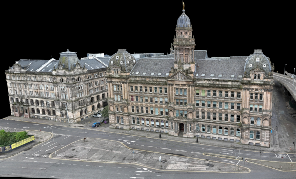
As part of a cladding remediation project on Morrison Street in Glasgow, SolidPoint were appointed to carry out a 3D drone survey and measured building survey of a mixed-use residential and commercial building.
Client Goals
Our client was undertaking refurbishment works to improve the building's fire safety, including compartmentation, external cladding improvements and new rendering. To plan these works effectively, they required accurate information about the existing building façade, particularly the positioning of windows and external features.
Our Approach
A key challenge was capturing the upper sections of the building, where traditional ground-based laser scanning could not provide complete coverage. By combining drone surveying with 3D laser scanning, we could capture these difficult-to-reach areas while providing the detailed measurements needed to support the remediation design.
The drone survey captured high-resolution imagery of the roof, upper elevations and external cladding, including areas that were inaccessible to our team and regular equipment.
Our measured building survey alongside it captured precise measurements of the building's existing geometry, including window positions, façade details and elevations.
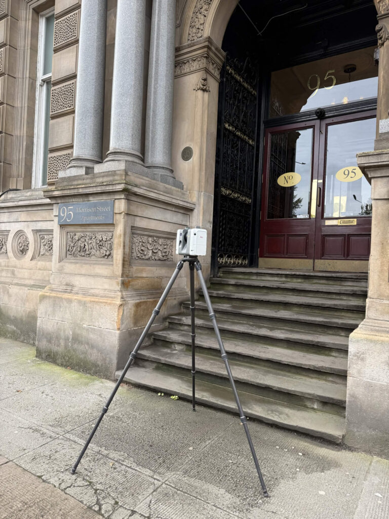
The two survey methods complement one another perfectly, providing both detailed visual coverage and measurements. This information is now being used to develop existing building elevations and support the planning of fireproofing and refurbishment works.
Project Deliverables
Our client received:
-
- High-resolution drone imagery and survey data
- Point cloud data of the existing building
- Building elevations in CAD and Revit formats
- 3D drone model for visual reference
How Did Our Client Benefit From a SolidPoint Survey?
Complete Building Visibility
The drone captured upper elevations, roof areas and cladding details that were difficult to reach using traditional surveying methods, while laser scanning provided accurate measurements of accessible building features.
This allowed the client to assess the external façade and plan remediation works using detailed information from across the building.
Reduced Costs and Faster Delivery
Using drone surveying reduced the need for scaffolding or specialist access equipment purely for survey data collection.
Capturing difficult-to-reach areas remotely also helped streamline the surveying process, reducing disruption and the potential need for additional site visits.
By combining both survey methods, the client could obtain detailed building information efficiently, helping keep the wider refurbishment programme moving.
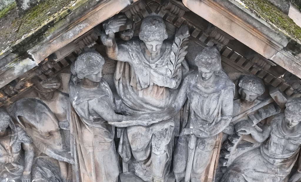
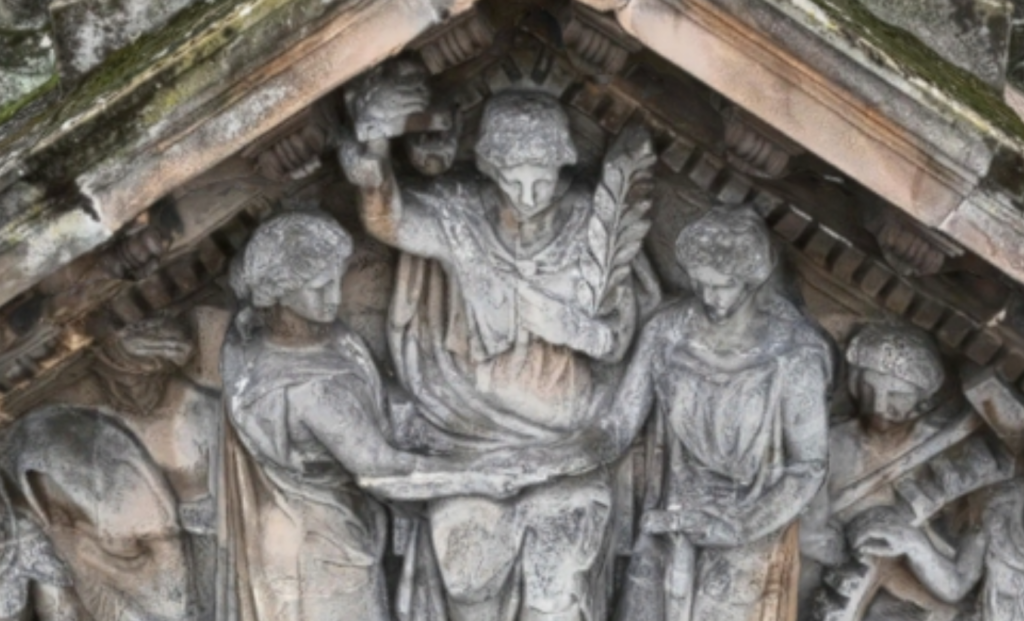
Drone image → Drone model
Accurate Data That Reduces Risk
Accurate existing building information is particularly important when planning cladding remediation and fire safety improvements.
The measured building survey provided precise measurements of window locations, building levels and external features, helping the design team determine where fireproofing and other remediation measures needed to be incorporated.
Combined with detailed drone imagery, this information helped reduce uncertainty during the design stage, minimising the risk of incorrect assumptions, design clashes and costly rework.
Why Choose SolidPoint?
The Morrison Street project demonstrates the value of combining 3D drone surveys and traditional survey methods for complex building refurbishment and cladding remediation projects.
By capturing both inaccessible external areas and accurate existing building measurements, SolidPoint provided the information needed to support the planning of fire safety improvements.
The combination of detailed drone imagery, point cloud data and building elevations gave the client a reliable foundation for developing their remediation plans with greater confidence.
Planning a cladding remediation or building refurbishment project? Contact SolidPoint to find out how our drone surveys and point cloud surveys can provide the accurate existing building information your project needs.
Read our other similar projects:
Request a Proposal
Tell us about your survey and we’ll help you take the next step.




Trusted Suppliers for: